Little Falls geodata
Little Falls (Minnesota) is a seat of a second-order administrative division; located in United States in America/Chicago (GMT-5) time zone. With population of 8,649 people, there are 4949 cities with bigger population in this country. Compared to other cities in United States, 95% of cities are located further ↓South; 69.5% of cities are located further →East and 78.4% of cities have lower elevation than Little Falls. Note1
Administrative division(s):
- Level 1: Minnesota
- Level 2: Morrison County
- Level 3: City of Little Falls


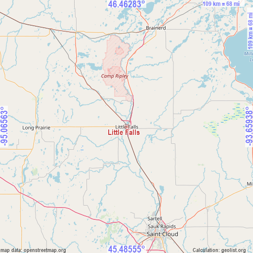
Little Falls GPS coordinates[2]
45° 58' 34.86" North, 94° 21' 45" West
| Map corner | latitude | longitude |
|---|---|---|
| Upper-left | 46.46283°, | -95.06563° |
| Center: | 45.97635°, | -94.3625° |
| Lower-right: | 45.48555°, | -93.65938° |
| Map W x H: | 108.7×108.7 km | = 67.5×67.5mi |
| max Lat: | 71.29058° ⇑5% North |
| Little Falls: | 45.97635° |
| min Lat: | ⇓95% South 19.06759° |
| min Long | Little Falls | max Long |
| -171.73463° | -94.3625° | -66.98998° |
| W 30.5%⇐ | ⇒69.5% E |
Elevation
Elevation of Little Falls is 339 m = 1112 ft, and this is 44.2 m = 145 ft above average elevation for this country.
| Max E: |
3189 m = 10463 ft | 21.6% |
| Little Falls | 339 m 1112 ft | |
| Avg. | 294.8 m = 967 ft | |
Min E: |
-60 m = -197 ft | 78.4% |
See also: United States elevation on elevation.city.
Geographical zone
Little Falls is located in North temperate zone (between Tropic of Cancer and the Arctic Circle). Distance of this North polar circle is 2289.1 km =1422.4 mi to North.| Distance of | km | miles | from Little Falls |
|---|---|---|---|
| North Pole | 4895 | 3041.6 | to North |
| Arctic Circle | 2289.1 | 1422.4 | to North |
| Tropic Cancer | 2506.2 | 1557.3 | to South |
| Equator | 5112.1 | 3176.5 | to South |


Nearby cities:
15 places around Little Falls: (largest is in red/bold)
• Albany
41.7 km =25.9 mi,  202°
202°
• Avon
41.4 km =25.7 mi,  189°
189°
• Baxter
41.2 km =25.6 mi,  8°
8°
• Brainerd
44.2 km =27.5 mi,  16°
16°
• Browerville
40.7 km =25.3 mi,  287°
287°
• Collegeville
42.5 km =26.4 mi,  180°
180°
• Freeport
43.1 km =26.8 mi,  216°
216°
• Holdingford
28.5 km =17.7 mi, 196°
• Long Prairie
38.9 km =24.2 mi,  269°
269°
• Pierz
19.9 km =12.4 mi,  88°
88°
• Randall
16.8 km =10.4 mi,  319°
319°
• Rice
27.3 km =17 mi,  156°
156°
• Royalton
17.1 km =10.6 mi, 161°
• Saint Stephen
31.2 km =19.4 mi,  167°
167°
• Sartell
41.2 km =25.6 mi, 162°
Sources, notices
• [Note1] Compared only with cities in United States existing in our database
• [Src1] Map data: © OpenStreetMap contributors (CC-BY-SA)
• [Src2] Other city data from geonames.org with taken over terms of usage.
• [Src3] Geographical zone / Annual Mean Temperature by Robert A. Rohde @ Wikipedia
