Devils Lake geodata
Devils Lake (North Dakota) is a seat of a second-order administrative division; located in United States in America/Chicago (GMT-5) time zone. With population of 7,351 people, there are 5620 cities with bigger population in this country. Compared to other cities in United States, 98.8% of cities are located further ↓South; 79.8% of cities are located further →East and 85.8% of cities have lower elevation than Devils Lake. Note1
Administrative division(s):
- Level 1: North Dakota
- Level 2: Ramsey County
- Level 3: City of Devils Lake


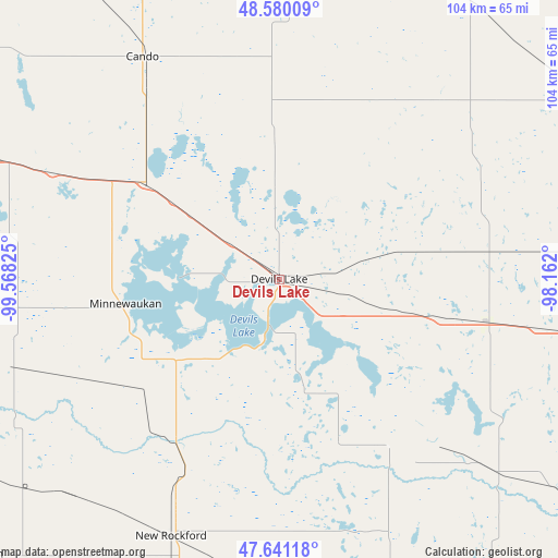
Devils Lake GPS coordinates[2]
48° 6' 46.008" North, 98° 51' 54.432" West
| Map corner | latitude | longitude |
|---|---|---|
| Upper-left | 48.58009°, | -99.56825° |
| Center: | 48.11278°, | -98.86512° |
| Lower-right: | 47.64118°, | -98.162° |
| Map W x H: | 104.4×104.4 km | = 64.9×64.9mi |
| max Lat: | 71.29058° ⇑1.2% North |
| Devils Lake: | 48.11278° |
| min Lat: | ⇓98.8% South 19.06759° |
| min Long | Devils Lake | max Long |
| -171.73463° | -98.86512° | -66.98998° |
| W 20.2%⇐ | ⇒79.8% E |
Elevation
Elevation of Devils Lake is 439 m = 1440 ft, and this is 144.2 m = 473 ft above average elevation for this country.
| Max E: |
3189 m = 10463 ft | 14.2% |
| Devils Lake | 439 m 1440 ft | |
| Avg. | 294.8 m = 967 ft | |
Min E: |
-60 m = -197 ft | 85.8% |
See also: United States elevation on elevation.city.
Geographical zone
Devils Lake is located in North temperate zone (between Tropic of Cancer and the Arctic Circle). Distance of this North polar circle is 2051.5 km =1274.7 mi to North.| Distance of | km | miles | from Devils Lake |
|---|---|---|---|
| North Pole | 4657.4 | 2894 | to North |
| Arctic Circle | 2051.5 | 1274.7 | to North |
| Tropic Cancer | 2743.7 | 1704.9 | to South |
| Equator | 5349.6 | 3324.1 | to South |


Nearby cities:
15 places around Devils Lake: (largest is in red/bold)
• Cando
48.8 km =30.3 mi,  328°
328°
• Carrington
76.3 km =47.4 mi,  194°
194°
• Cooperstown
92.7 km =57.6 mi,  143°
143°
• Fessenden
76.8 km =47.7 mi,  227°
227°
• Fort Totten
17.6 km =10.9 mi,  212°
212°
• Harvey
88.4 km =54.9 mi,  244°
244°
• Lakota
40.1 km =24.9 mi,  101°
101°
• Langdon
80.8 km =50.2 mi,  26°
26°
• Larimore
94.9 km =59 mi, 103°
• Minnewaukan
29.1 km =18.1 mi,  260°
260°
• New Rockford
52.2 km =32.4 mi,  202°
202°
• Park River
89.1 km =55.4 mi,  69°
69°
• Rolette
94.4 km =58.7 mi,  310°
310°
• Rolla
99.7 km =62 mi, 326°
• Rugby
88.5 km =55 mi,  288°
288°
Sources, notices
• [Note1] Compared only with cities in United States existing in our database
• [Src1] Map data: © OpenStreetMap contributors (CC-BY-SA)
• [Src2] Other city data from geonames.org with taken over terms of usage.
• [Src3] Geographical zone / Annual Mean Temperature by Robert A. Rohde @ Wikipedia
