Cooperstown geodata
Cooperstown (North Dakota) is a seat of a second-order administrative division; located in United States in America/Chicago (GMT-5) time zone. With population of 945 people, there are 16673 cities with bigger population in this country. Compared to other cities in United States, 97.5% of cities are located further ↓South; 78.8% of cities are located further →East and 85.6% of cities have lower elevation than Cooperstown. Note1
Administrative division(s):
- Level 1: North Dakota
- Level 2: Griggs County
- Level 3: City of Cooperstown


Cooperstown GPS coordinates[2]
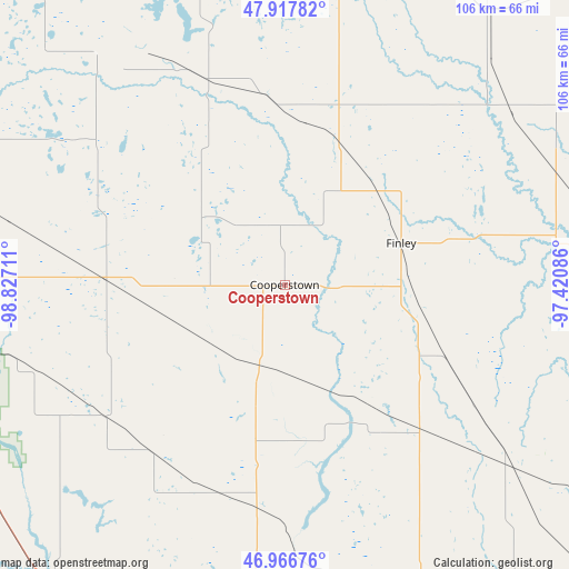
47° 26' 39.984" North, 98° 7' 26.328" West
| Map corner | latitude | longitude |
|---|---|---|
| Upper-left | 47.91782°, | -98.82711° |
| Center: | 47.44444°, | -98.12398° |
| Lower-right: | 46.96676°, | -97.42086° |
| Map W x H: | 105.7×105.7 km | = 65.7×65.7mi |
| max Lat: | 71.29058° ⇑2.5% North |
| Cooperstown: | 47.44444° |
| min Lat: | ⇓97.5% South 19.06759° |
| min Long | Cooperstown | max Long |
| -171.73463° | -98.12398° | -66.98998° |
| W 21.2%⇐ | ⇒78.8% E |
Elevation
Elevation of Cooperstown is 435 m = 1427 ft, and this is 140.2 m = 460 ft above average elevation for this country.
| Max E: |
3189 m = 10463 ft | 14.4% |
| Cooperstown | 435 m 1427 ft | |
| Avg. | 294.8 m = 967 ft | |
Min E: |
-60 m = -197 ft | 85.6% |
See also: United States elevation on elevation.city.
Geographical zone
Cooperstown is located in North temperate zone (between Tropic of Cancer and the Arctic Circle). Distance of this North polar circle is 2125.8 km =1320.9 mi to North.| Distance of | km | miles | from Cooperstown |
|---|---|---|---|
| North Pole | 4731.7 | 2940.1 | to North |
| Arctic Circle | 2125.8 | 1320.9 | to North |
| Tropic Cancer | 2669.4 | 1658.7 | to South |
| Equator | 5275.3 | 3277.9 | to South |


Nearby cities:
15 places around Cooperstown: (largest is in red/bold)
• Carrington
75.4 km =46.9 mi,  270°
270°
• Finley
23 km =14.3 mi,  70°
70°
• Fort Totten
88.2 km =54.8 mi,  312°
312°
• Grand Forks Air Force Base
79.2 km =49.2 mi,  44°
44°
• Hatton
54.8 km =34.1 mi, 66°
• Hillsboro
80 km =49.7 mi,  93°
93°
• Jamestown
74 km =46 mi,  216°
216°
• Lakota
68.4 km =42.5 mi,  346°
346°
• Larimore
63.5 km =39.5 mi, 35°
• Mayville
60.4 km =37.5 mi,  84°
84°
• New Rockford
80.5 km =50 mi,  288°
288°
• Northwood
52.8 km =32.8 mi,  52°
52°
• Portland
57 km =35.4 mi, 83°
• Thompson
84.4 km =52.4 mi,  64°
64°
• Valley City
58.7 km =36.5 mi,  171°
171°
Sources, notices
• [Note1] Compared only with cities in United States existing in our database
• [Src1] Map data: © OpenStreetMap contributors (CC-BY-SA)
• [Src2] Other city data from geonames.org with taken over terms of usage.
• [Src3] Geographical zone / Annual Mean Temperature by Robert A. Rohde @ Wikipedia
