Carrington geodata
Carrington (North Dakota) is a seat of a second-order administrative division; located in United States in America/Chicago (GMT-5) time zone. With population of 2,072 people, there are 11713 cities with bigger population in this country. Compared to other cities in United States, 97.5% of cities are located further ↓South; 80% of cities are located further →East and 87.4% of cities have lower elevation than Carrington. Note1
Administrative division(s):
- Level 1: North Dakota
- Level 2: Foster County
- Level 3: City of Carrington


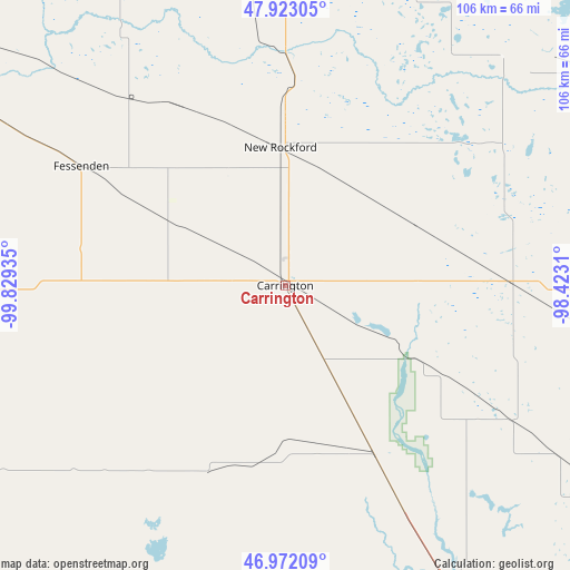
Carrington GPS coordinates[2]
47° 26' 58.992" North, 99° 7' 34.392" West
| Map corner | latitude | longitude |
|---|---|---|
| Upper-left | 47.92305°, | -99.82935° |
| Center: | 47.44972°, | -99.12622° |
| Lower-right: | 46.97209°, | -98.4231° |
| Map W x H: | 105.7×105.7 km | = 65.7×65.7mi |
| max Lat: | 71.29058° ⇑2.5% North |
| Carrington: | 47.44972° |
| min Lat: | ⇓97.5% South 19.06759° |
| min Long | Carrington | max Long |
| -171.73463° | -99.12622° | -66.98998° |
| W 20%⇐ | ⇒80% E |
Elevation
Elevation of Carrington is 483 m = 1585 ft, and this is 188.2 m = 617 ft above average elevation for this country.
| Max E: |
3189 m = 10463 ft | 12.6% |
| Carrington | 483 m 1585 ft | |
| Avg. | 294.8 m = 967 ft | |
Min E: |
-60 m = -197 ft | 87.4% |
See also: United States elevation on elevation.city.
Geographical zone
Carrington is located in North temperate zone (between Tropic of Cancer and the Arctic Circle). Distance of this North polar circle is 2125.3 km =1320.6 mi to North.| Distance of | km | miles | from Carrington |
|---|---|---|---|
| North Pole | 4731.1 | 2939.8 | to North |
| Arctic Circle | 2125.3 | 1320.6 | to North |
| Tropic Cancer | 2670 | 1659.1 | to South |
| Equator | 5275.9 | 3278.3 | to South |


Nearby cities:
15 places around Carrington: (largest is in red/bold)
• Cando
115.5 km =71.8 mi,  356°
356°
• Cooperstown
75.4 km =46.9 mi,  90°
90°
• Devils Lake
76.3 km =47.4 mi,  14°
14°
• Fessenden
43.8 km =27.2 mi,  300°
300°
• Finley
97.2 km =60.4 mi, 85°
• Fort Totten
59.8 km =37.2 mi, 9°
• Harvey
70.3 km =43.7 mi, 300°
• Jamestown
67.8 km =42.1 mi,  152°
152°
• Lakota
88.5 km =55 mi,  41°
41°
• McClusky
99.1 km =61.6 mi,  272°
272°
• Minnewaukan
69.8 km =43.4 mi,  352°
352°
• Napoleon
115.5 km =71.8 mi,  205°
205°
• New Rockford
25.6 km =15.9 mi, 358°
• Steele
89.1 km =55.4 mi,  222°
222°
• Valley City
103.1 km =64.1 mi,  124°
124°
Sources, notices
• [Note1] Compared only with cities in United States existing in our database
• [Src1] Map data: © OpenStreetMap contributors (CC-BY-SA)
• [Src2] Other city data from geonames.org with taken over terms of usage.
• [Src3] Geographical zone / Annual Mean Temperature by Robert A. Rohde @ Wikipedia
