Ainsworth geodata
Ainsworth (Nebraska) is a seat of a second-order administrative division; located in United States in America/Chicago (GMT-5) time zone. With population of 1,626 people, there are 13190 cities with bigger population in this country. Compared to other cities in United States, 80.2% of cities are located further ↓South; 80.7% of cities are located further →East and 91.7% of cities have lower elevation than Ainsworth. Note1


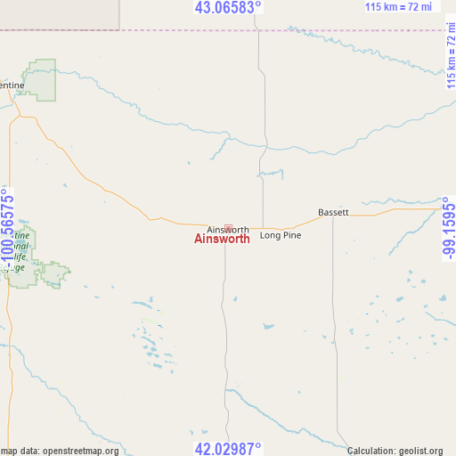
Ainsworth GPS coordinates[2]
42° 33' 0" North, 99° 51' 45.432" West
| Map corner | latitude | longitude |
|---|---|---|
| Upper-left | 43.06583°, | -100.56575° |
| Center: | 42.55°, | -99.86262° |
| Lower-right: | 42.02987°, | -99.1595° |
| Map W x H: | 115.2×115.2 km | = 71.6×71.6mi |
| max Lat: | 71.29058° ⇑19.8% North |
| Ainsworth: | 42.55° |
| min Lat: | ⇓80.2% South 19.06759° |
| min Long | Ainsworth | max Long |
| -171.73463° | -99.86262° | -66.98998° |
| W 19.3%⇐ | ⇒80.7% E |
Elevation
Elevation of Ainsworth is 771 m = 2530 ft, and this is 476.2 m = 1562 ft above average elevation for this country.
| Max E: |
3189 m = 10463 ft | 8.3% |
| Ainsworth | 771 m 2530 ft | |
| Avg. | 294.8 m = 967 ft | |
Min E: |
-60 m = -197 ft | 91.7% |
See also: United States elevation on elevation.city.
Geographical zone
Ainsworth is located in North temperate zone (between Tropic of Cancer and the Arctic Circle). Distance of this Northern Tropic circle is 2125.2 km =1320.5 mi to South.| Distance of | km | miles | from Ainsworth |
|---|---|---|---|
| North Pole | 5275.9 | 3278.3 | to North |
| Arctic Circle | 2670.1 | 1659.1 | to North |
| Tropic Cancer | 2125.2 | 1320.5 | to South |
| Equator | 4731.1 | 2939.8 | to South |


Nearby cities:
15 places around Ainsworth: (largest is in red/bold)
• Antelope
104.4 km =64.9 mi,  323°
323°
• Atkinson
72.5 km =45 mi,  91°
91°
• Bassett
26.9 km =16.7 mi,  81°
81°
• Brewster
67.9 km =42.2 mi,  180°
180°
• Burke
84.3 km =52.4 mi,  33°
33°
• Burwell
104.5 km =64.9 mi,  144°
144°
• Butte
92 km =57.2 mi,  64°
64°
• Gregory
83.6 km =51.9 mi,  24°
24°
• O'Neill
100.1 km =62.2 mi,  95°
95°
• Springview
31.9 km =19.8 mi, 16°
• Stuart
59.2 km =36.8 mi, 84°
• Taylor
95.4 km =59.3 mi,  155°
155°
• Thedford
86.5 km =53.7 mi,  222°
222°
• Valentine
66.7 km =41.4 mi,  302°
302°
• Winner
91.9 km =57.1 mi,  0°
0°
Sources, notices
• [Note1] Compared only with cities in United States existing in our database
• [Src1] Map data: © OpenStreetMap contributors (CC-BY-SA)
• [Src2] Other city data from geonames.org with taken over terms of usage.
• [Src3] Geographical zone / Annual Mean Temperature by Robert A. Rohde @ Wikipedia
