Brewster geodata
Brewster (Nebraska) is a seat of a second-order administrative division; located in United States in America/Chicago (GMT-5) time zone. With population of 18 people, there are 21055 cities with bigger population in this country. Compared to other cities in United States, 75.1% of cities are located further ↓South; 80.7% of cities are located further →East and 91.6% of cities have lower elevation than Brewster. Note1


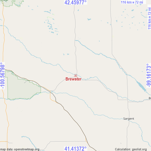
Brewster GPS coordinates[2]
41° 56' 20.004" North, 99° 51' 53.46" West
| Map corner | latitude | longitude |
|---|---|---|
| Upper-left | 42.45977°, | -100.56798° |
| Center: | 41.93889°, | -99.86485° |
| Lower-right: | 41.41372°, | -99.16173° |
| Map W x H: | 116.3×116.3 km | = 72.3×72.3mi |
| max Lat: | 71.29058° ⇑24.9% North |
| Brewster: | 41.93889° |
| min Lat: | ⇓75.1% South 19.06759° |
| min Long | Brewster | max Long |
| -171.73463° | -99.86485° | -66.98998° |
| W 19.3%⇐ | ⇒80.7% E |
Elevation
Elevation of Brewster is 763 m = 2503 ft, and this is 468.2 m = 1536 ft above average elevation for this country.
| Max E: |
3189 m = 10463 ft | 8.4% |
| Brewster | 763 m 2503 ft | |
| Avg. | 294.8 m = 967 ft | |
Min E: |
-60 m = -197 ft | 91.6% |
See also: United States elevation on elevation.city.
Geographical zone
Brewster is located in North temperate zone (between Tropic of Cancer and the Arctic Circle). Distance of this Northern Tropic circle is 2057.2 km =1278.3 mi to South.| Distance of | km | miles | from Brewster |
|---|---|---|---|
| North Pole | 5343.9 | 3320.5 | to North |
| Arctic Circle | 2738 | 1701.3 | to North |
| Tropic Cancer | 2057.2 | 1278.3 | to South |
| Equator | 4663.2 | 2897.6 | to South |


Nearby cities:
15 places around Brewster: (largest is in red/bold)
• Ainsworth
67.9 km =42.2 mi,  0°
0°
• Arnold
63.6 km =39.5 mi,  205°
205°
• Atkinson
98.3 km =61.1 mi,  47°
47°
• Bassett
76.8 km =47.7 mi,  20°
20°
• Broken Bow
62.6 km =38.9 mi,  162°
162°
• Burwell
63.1 km =39.2 mi,  106°
106°
• Callaway
72.1 km =44.8 mi,  183°
183°
• Mullen
98 km =60.9 mi,  276°
276°
• Ord
86.3 km =53.6 mi,  115°
115°
• Sargent
52.7 km =32.7 mi,  129°
129°
• Springview
98.9 km =61.5 mi,  5°
5°
• Stapleton
74.1 km =46 mi,  226°
226°
• Stuart
94.5 km =58.7 mi,  38°
38°
• Taylor
44.4 km =27.6 mi, 114°
• Thedford
59 km =36.7 mi,  274°
274°
Sources, notices
• [Note1] Compared only with cities in United States existing in our database
• [Src1] Map data: © OpenStreetMap contributors (CC-BY-SA)
• [Src2] Other city data from geonames.org with taken over terms of usage.
• [Src3] Geographical zone / Annual Mean Temperature by Robert A. Rohde @ Wikipedia
