Chesterfield geodata
Chesterfield (New Hampshire) is a populated place; located in United States in America/New_York (GMT-4) time zone. With population of 3,773 people, there are 8496 cities with bigger population in this country. Compared to other cities in United States, 82.4% of cities are located further ↓South; 94.9% of cities are located further ←West and 64.3% of cities have lower elevation than Chesterfield. Note1
Administrative division(s):
- Level 1: New Hampshire
- Level 2: Cheshire County
- Level 3: Town of Chesterfield


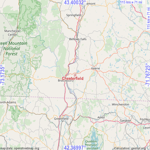
Chesterfield GPS coordinates[2]
42° 53' 14.28" North, 72° 28' 13.332" West
| Map corner | latitude | longitude |
|---|---|---|
| Upper-left | 43.40032°, | -73.1735° |
| Center: | 42.8873°, | -72.47037° |
| Lower-right: | 42.36997°, | -71.76725° |
| Map W x H: | 114.6×114.6 km | = 71.2×71.2mi |
| max Lat: | 71.29058° ⇑17.6% North |
| Chesterfield: | 42.8873° |
| min Lat: | ⇓82.4% South 19.06759° |
| min Long | Chesterfield | max Long |
| -171.73463° | -72.47037° | -66.98998° |
| W 94.9%⇐ | ⇒5.1% E |
Elevation
Elevation of Chesterfield is 259 m = 850 ft, and this is 35.8 m = 117 ft below average elevation for this country.
| Max E: |
3189 m = 10463 ft | 35.7% |
| Avg. | 294.8 m = 967 ft | |
| Chesterfield | 259 m = 850 ft | |
Min E: |
-60 m = -197 ft | 64.3% |
See also: United States elevation on elevation.city.
Geographical zone
Chesterfield is located in North temperate zone (between Tropic of Cancer and the Arctic Circle). Distance of this Northern Tropic circle is 2162.7 km =1343.8 mi to South.| Distance of | km | miles | from Chesterfield |
|---|---|---|---|
| North Pole | 5238.4 | 3255 | to North |
| Arctic Circle | 2632.6 | 1635.8 | to North |
| Tropic Cancer | 2162.7 | 1343.8 | to South |
| Equator | 4768.6 | 2963.1 | to South |


Nearby cities:
15 places around Chesterfield: (largest is in red/bold)
• Brattleboro
8.2 km =5.1 mi,  240°
240°
• Hinsdale
11.3 km =7 mi,  186°
186°
• Keene
16.5 km =10.3 mi,  71°
71°
• Marlborough
21.5 km =13.4 mi,  84°
84°
• Newfane
18.6 km =11.6 mi,  305°
305°
• Northfield
21.3 km =13.2 mi,  176°
176°
• Putney
10.6 km =6.6 mi,  336°
336°
• Richmond
21.9 km =13.6 mi,  132°
132°
• Surry
18.9 km =11.7 mi,  39°
39°
• Swanzey
15.5 km =9.6 mi,  97°
97°
• Walpole
21.7 km =13.5 mi,  9°
9°
• West Brattleboro
11.4 km =7.1 mi,  252°
252°
• West Swanzey
12.3 km =7.6 mi, 98°
• Westmoreland
8.6 km =5.3 mi,  15°
15°
• Winchester
14.5 km =9 mi,  150°
150°
Sources, notices
• [Note1] Compared only with cities in United States existing in our database
• [Src1] Map data: © OpenStreetMap contributors (CC-BY-SA)
• [Src2] Other city data from geonames.org with taken over terms of usage.
• [Src3] Geographical zone / Annual Mean Temperature by Robert A. Rohde @ Wikipedia
