Sullivan geodata
Sullivan (New Hampshire) is a populated place; located in United States in America/New_York (GMT-4) time zone. With population of 795 people, there are 17856 cities with bigger population in this country. Compared to other cities in United States, 83.4% of cities are located further ↓South; 95.3% of cities are located further ←West and 85.5% of cities have lower elevation than Sullivan. Note1
Administrative division(s):
- Level 1: New Hampshire
- Level 2: Cheshire County
- Level 3: Town of Sullivan


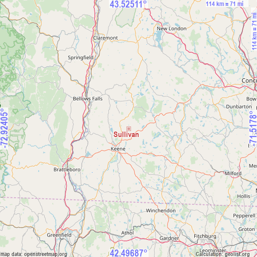
Sullivan GPS coordinates[2]
43° 0' 47.304" North, 72° 13' 15.312" West
| Map corner | latitude | longitude |
|---|---|---|
| Upper-left | 43.52511°, | -72.92405° |
| Center: | 43.01314°, | -72.22092° |
| Lower-right: | 42.49687°, | -71.5178° |
| Map W x H: | 114.3×114.3 km | = 71×71mi |
| max Lat: | 71.29058° ⇑16.6% North |
| Sullivan: | 43.01314° |
| min Lat: | ⇓83.4% South 19.06759° |
| min Long | Sullivan | max Long |
| -171.73463° | -72.22092° | -66.98998° |
| W 95.3%⇐ | ⇒4.7% E |
Elevation
Elevation of Sullivan is 434 m = 1424 ft, and this is 139.2 m = 457 ft above average elevation for this country.
| Max E: |
3189 m = 10463 ft | 14.5% |
| Sullivan | 434 m 1424 ft | |
| Avg. | 294.8 m = 967 ft | |
Min E: |
-60 m = -197 ft | 85.5% |
See also: United States elevation on elevation.city.
Geographical zone
Sullivan is located in North temperate zone (between Tropic of Cancer and the Arctic Circle). Distance of this Northern Tropic circle is 2176.7 km =1352.5 mi to South.| Distance of | km | miles | from Sullivan |
|---|---|---|---|
| North Pole | 5224.4 | 3246.3 | to North |
| Arctic Circle | 2618.6 | 1627.1 | to North |
| Tropic Cancer | 2176.7 | 1352.5 | to South |
| Equator | 4782.6 | 2971.8 | to South |


Nearby cities:
15 places around Sullivan: (largest is in red/bold)
• Alstead
18.9 km =11.7 mi,  323°
323°
• Dublin
17.4 km =10.8 mi,  132°
132°
• Gilsum
5.2 km =3.2 mi, 319°
• Harrisville
12.6 km =7.8 mi, 126°
• Keene
10 km =6.2 mi,  207°
207°
• Marlborough
12.2 km =7.6 mi,  174°
174°
• Marlow
11.6 km =7.2 mi,  9°
9°
• Nelson
7.7 km =4.8 mi,  108°
108°
• Stoddard
11.3 km =7 mi,  49°
49°
• Surry
8.2 km =5.1 mi,  273°
273°
• Swanzey
16.7 km =10.4 mi,  197°
197°
• Walpole
18.2 km =11.3 mi,  293°
293°
• Washington
20.7 km =12.9 mi,  29°
29°
• West Swanzey
17.9 km =11.1 mi, 207°
• Westmoreland
18.9 km =11.7 mi,  252°
252°
Sources, notices
• [Note1] Compared only with cities in United States existing in our database
• [Src1] Map data: © OpenStreetMap contributors (CC-BY-SA)
• [Src2] Other city data from geonames.org with taken over terms of usage.
• [Src3] Geographical zone / Annual Mean Temperature by Robert A. Rohde @ Wikipedia
