Bloomingdale geodata
Bloomingdale (New Jersey) is a populated place; located in United States in America/New_York (GMT-4) time zone. With population of 8,215 people, there are 5185 cities with bigger population in this country. Compared to other cities in United States, 65.9% of cities are located further ↓South; 89% of cities are located further ←West and 73% of cities have higher elevation than Bloomingdale. Note1
Administrative division(s):
- Level 1: New Jersey
- Level 2: Passaic County
- Level 3: Borough of Bloomingdale


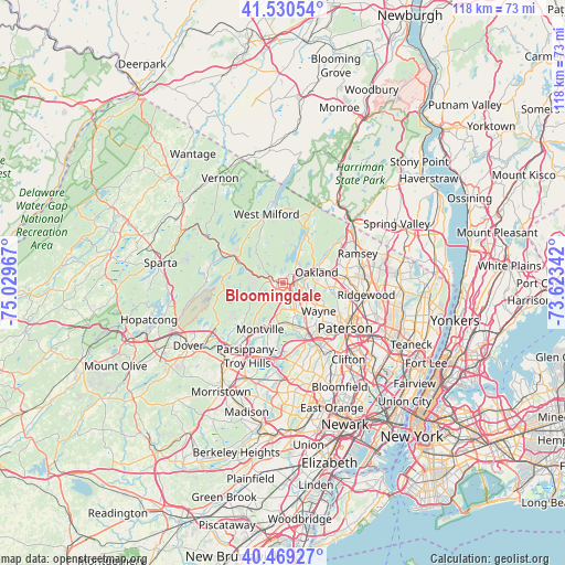
Bloomingdale GPS coordinates[2]
41° 0' 7.344" North, 74° 19' 35.544" West
| Map corner | latitude | longitude |
|---|---|---|
| Upper-left | 41.53054°, | -75.02967° |
| Center: | 41.00204°, | -74.32654° |
| Lower-right: | 40.46927°, | -73.62342° |
| Map W x H: | 118×118 km | = 73.3×73.3mi |
| max Lat: | 71.29058° ⇑34.1% North |
| Bloomingdale: | 41.00204° |
| min Lat: | ⇓65.9% South 19.06759° |
| min Long | Bloomingdale | max Long |
| -171.73463° | -74.32654° | -66.98998° |
| W 89%⇐ | ⇒11% E |
Elevation
Elevation of Bloomingdale is 83 m = 272 ft, and this is 211.8 m = 695 ft below average elevation for this country.
| Max E: |
3189 m = 10463 ft | 73% |
| Avg. | 294.8 m = 967 ft | |
| Bloomingdale | 83 m = 272 ft | |
Min E: |
-60 m = -197 ft | 27% |
See also: United States elevation on elevation.city.
Geographical zone
Bloomingdale is located in North temperate zone (between Tropic of Cancer and the Arctic Circle). Distance of this Northern Tropic circle is 1953.1 km =1213.6 mi to South.| Distance of | km | miles | from Bloomingdale |
|---|---|---|---|
| North Pole | 5448.1 | 3385.3 | to North |
| Arctic Circle | 2842.2 | 1766.1 | to North |
| Tropic Cancer | 1953.1 | 1213.6 | to South |
| Equator | 4559 | 2832.8 | to South |


Nearby cities:
15 places around Bloomingdale: (largest is in red/bold)
• Boonton
13 km =8.1 mi,  211°
211°
• Butler
1.3 km =0.8 mi,  278°
278°
• Fairfield
13.3 km =8.3 mi,  172°
172°
• Franklin Lakes
10.3 km =6.4 mi,  80°
80°
• Haledon
13.9 km =8.6 mi,  122°
122°
• Kinnelon
3.4 km =2.1 mi,  269°
269°
• Lincoln Park
8.9 km =5.5 mi, 166°
• North Haledon
12.9 km =8 mi,  113°
113°
• Oakland
5.4 km =3.4 mi, 76°
• Pompton Lakes
3 km =1.9 mi, 82°
• Ringwood
14.1 km =8.8 mi,  28°
28°
• Riverdale
2.1 km =1.3 mi, 114°
• Wanaque
4.9 km =3 mi, 34°
• Wayne
9.5 km =5.9 mi,  153°
153°
• Wyckoff
12.9 km =8 mi,  86°
86°
Sources, notices
• [Note1] Compared only with cities in United States existing in our database
• [Src1] Map data: © OpenStreetMap contributors (CC-BY-SA)
• [Src2] Other city data from geonames.org with taken over terms of usage.
• [Src3] Geographical zone / Annual Mean Temperature by Robert A. Rohde @ Wikipedia
