Flatbush geodata
Flatbush (New York) is a populated place; located in United States in America/New_York (GMT-4) time zone. With population of 93,361 people, there are 389 cities with bigger population in this country. Compared to other cities in United States, 60.8% of cities are located further ↓South; 90.9% of cities are located further ←West and 89.1% of cities have higher elevation than Flatbush. Note1


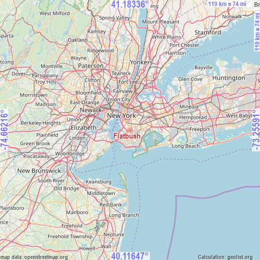
Flatbush GPS coordinates[2]
40° 39' 7.38" North, 73° 57' 32.508" West
| Map corner | latitude | longitude |
|---|---|---|
| Upper-left | 41.18336°, | -74.66216° |
| Center: | 40.65205°, | -73.95903° |
| Lower-right: | 40.11647°, | -73.25591° |
| Map W x H: | 118.6×118.6 km | = 73.7×73.7mi |
| max Lat: | 71.29058° ⇑39.2% North |
| Flatbush: | 40.65205° |
| min Lat: | ⇓60.8% South 19.06759° |
| min Long | Flatbush | max Long |
| -171.73463° | -73.95903° | -66.98998° |
| W 90.9%⇐ | ⇒9.1% E |
Elevation
Elevation of Flatbush is 18 m = 59 ft, and this is 276.8 m = 908 ft below average elevation for this country.
| Max E: |
3189 m = 10463 ft | 89.1% |
| Avg. | 294.8 m = 967 ft | |
| Flatbush | 18 m = 59 ft | |
Min E: |
-60 m = -197 ft | 10.9% |
See also: Flatbush elevation on elevation.city.
Geographical zone
Flatbush is located in North temperate zone (between Tropic of Cancer and the Arctic Circle). Distance of this Northern Tropic circle is 1914.2 km =1189.4 mi to South.| Distance of | km | miles | from Flatbush |
|---|---|---|---|
| North Pole | 5487 | 3409.5 | to North |
| Arctic Circle | 2881.1 | 1790.2 | to North |
| Tropic Cancer | 1914.2 | 1189.4 | to South |
| Equator | 4520.1 | 2808.7 | to South |


Nearby cities:
15 places around Flatbush: (largest is in red/bold)
• Bensonhurst
6.3 km =3.9 mi,  207°
207°
• Bergen Beach
5.6 km =3.5 mi,  128°
128°
• Borough Park
3.8 km =2.4 mi,  237°
237°
• Brooklyn
0.8 km =0.5 mi,  105°
105°
• Brooklyn Heights
5.6 km =3.5 mi,  328°
328°
• Brownsville
3.4 km =2.1 mi,  73°
73°
• Bushwick
5.8 km =3.6 mi,  35°
35°
• Canarsie
5 km =3.1 mi,  100°
100°
• Dyker Heights
5.5 km =3.4 mi,  231°
231°
• East Flatbush
2.4 km =1.5 mi,  85°
85°
• Flatlands
4 km =2.5 mi,  149°
149°
• Gravesend
6.1 km =3.8 mi,  184°
184°
• Kensington
1.2 km =0.7 mi, 236°
• Park Slope
3 km =1.9 mi,  311°
311°
• Sunset Park
4.6 km =2.9 mi,  260°
260°
Sources, notices
• [Note1] Compared only with cities in United States existing in our database
• [Src1] Map data: © OpenStreetMap contributors (CC-BY-SA)
• [Src2] Other city data from geonames.org with taken over terms of usage.
• [Src3] Geographical zone / Annual Mean Temperature by Robert A. Rohde @ Wikipedia
