Mariaville Lake geodata
Mariaville Lake (New York) is a populated place; located in United States in America/New_York (GMT-4) time zone. With population of 722 people, there are 18480 cities with bigger population in this country. Compared to other cities in United States, 82% of cities are located further ↓South; 89.8% of cities are located further ←West and 83.4% of cities have lower elevation than Mariaville Lake. Note1
Administrative division(s):
- Level 1: New York
- Level 2: Schenectady County
- Level 3: Town of Duanesburg


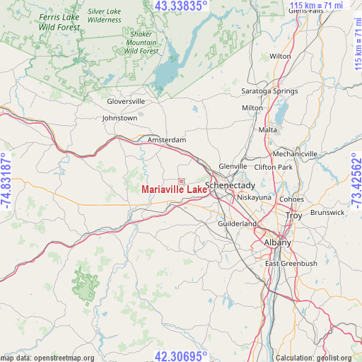
Mariaville Lake GPS coordinates[2]
42° 49' 29.28" North, 74° 7' 43.464" West
| Map corner | latitude | longitude |
|---|---|---|
| Upper-left | 43.33835°, | -74.83187° |
| Center: | 42.8248°, | -74.12874° |
| Lower-right: | 42.30695°, | -73.42562° |
| Map W x H: | 114.7×114.7 km | = 71.3×71.3mi |
| max Lat: | 71.29058° ⇑18% North |
| Mariaville Lake: | 42.8248° |
| min Lat: | ⇓82% South 19.06759° |
| min Long | Mariaville Lake | max Long |
| -171.73463° | -74.12874° | -66.98998° |
| W 89.8%⇐ | ⇒10.2% E |
Elevation
Elevation of Mariaville Lake is 396 m = 1299 ft, and this is 101.2 m = 332 ft above average elevation for this country.
| Max E: |
3189 m = 10463 ft | 16.6% |
| Mariaville Lake | 396 m 1299 ft | |
| Avg. | 294.8 m = 967 ft | |
Min E: |
-60 m = -197 ft | 83.4% |
See also: United States elevation on elevation.city.
Geographical zone
Mariaville Lake is located in North temperate zone (between Tropic of Cancer and the Arctic Circle). Distance of this Northern Tropic circle is 2155.8 km =1339.6 mi to South.| Distance of | km | miles | from Mariaville Lake |
|---|---|---|---|
| North Pole | 5245.4 | 3259.3 | to North |
| Arctic Circle | 2639.5 | 1640.1 | to North |
| Tropic Cancer | 2155.8 | 1339.6 | to South |
| Equator | 4761.7 | 2958.8 | to South |


Nearby cities:
15 places around Mariaville Lake: (largest is in red/bold)
• Altamont
15.8 km =9.8 mi,  150°
150°
• Amsterdam
13.6 km =8.5 mi,  339°
339°
• Central Bridge
21.3 km =13.2 mi,  233°
233°
• East Glenville
18.1 km =11.2 mi,  64°
64°
• Fonda
24.8 km =15.4 mi,  305°
305°
• Fultonville
24 km =14.9 mi,  304°
304°
• Hagaman
16.7 km =10.4 mi,  353°
353°
• Niskayuna
23.6 km =14.7 mi,  102°
102°
• Perth
22.1 km =13.7 mi, 346°
• Rotterdam
13.5 km =8.4 mi,  108°
108°
• Schenectady
15.5 km =9.6 mi,  94°
94°
• Schoharie
23 km =14.3 mi,  219°
219°
• Scotia
13.4 km =8.3 mi, 89°
• Tribes Hill
19.3 km =12 mi,  318°
318°
• Wellsville
13 km =8.1 mi, 295°
Sources, notices
• [Note1] Compared only with cities in United States existing in our database
• [Src1] Map data: © OpenStreetMap contributors (CC-BY-SA)
• [Src2] Other city data from geonames.org with taken over terms of usage.
• [Src3] Geographical zone / Annual Mean Temperature by Robert A. Rohde @ Wikipedia
