Voorheesville geodata
Voorheesville (New York) is a populated place; located in United States in America/New_York (GMT-4) time zone. With population of 2,832 people, there are 9943 cities with bigger population in this country. Compared to other cities in United States, 80.9% of cities are located further ↓South; 91% of cities are located further ←West and 70% of cities have higher elevation than Voorheesville. Note1


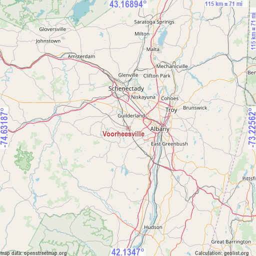
Voorheesville GPS coordinates[2]
42° 39' 14.292" North, 73° 55' 43.464" West
| Map corner | latitude | longitude |
|---|---|---|
| Upper-left | 43.16894°, | -74.63187° |
| Center: | 42.65397°, | -73.92874° |
| Lower-right: | 42.1347°, | -73.22562° |
| Map W x H: | 115×115 km | = 71.5×71.5mi |
| max Lat: | 71.29058° ⇑19.1% North |
| Voorheesville: | 42.65397° |
| min Lat: | ⇓80.9% South 19.06759° |
| min Long | Voorheesville | max Long |
| -171.73463° | -73.92874° | -66.98998° |
| W 91%⇐ | ⇒9% E |
Elevation
Elevation of Voorheesville is 101 m = 331 ft, and this is 193.8 m = 636 ft below average elevation for this country.
| Max E: |
3189 m = 10463 ft | 70% |
| Avg. | 294.8 m = 967 ft | |
| Voorheesville | 101 m = 331 ft | |
Min E: |
-60 m = -197 ft | 30% |
See also: United States elevation on elevation.city.
Geographical zone
Voorheesville is located in North temperate zone (between Tropic of Cancer and the Arctic Circle). Distance of this Northern Tropic circle is 2136.8 km =1327.7 mi to South.| Distance of | km | miles | from Voorheesville |
|---|---|---|---|
| North Pole | 5264.4 | 3271.1 | to North |
| Arctic Circle | 2658.5 | 1651.9 | to North |
| Tropic Cancer | 2136.8 | 1327.7 | to South |
| Equator | 4742.7 | 2947 | to South |


Nearby cities:
15 places around Voorheesville: (largest is in red/bold)
• Albany
14.1 km =8.8 mi,  90°
90°
• Altamont
10 km =6.2 mi,  301°
301°
• Colonie
10.5 km =6.5 mi,  47°
47°
• Delmar
8.6 km =5.3 mi,  114°
114°
• Hampton Manor
16.8 km =10.4 mi,  102°
102°
• Latham
17.3 km =10.7 mi, 53°
• McKownville
7.4 km =4.6 mi,  63°
63°
• Menands
17.2 km =10.7 mi,  75°
75°
• Niskayuna
15.5 km =9.6 mi,  25°
25°
• Rensselaer
15.3 km =9.5 mi, 94°
• Roessleville
10.9 km =6.8 mi,  65°
65°
• Rotterdam
15.2 km =9.4 mi,  346°
346°
• Schenectady
17.8 km =11.1 mi,  357°
357°
• West Albany
12.7 km =7.9 mi, 75°
• Westmere
6.4 km =4 mi, 49°
Sources, notices
• [Note1] Compared only with cities in United States existing in our database
• [Src1] Map data: © OpenStreetMap contributors (CC-BY-SA)
• [Src2] Other city data from geonames.org with taken over terms of usage.
• [Src3] Geographical zone / Annual Mean Temperature by Robert A. Rohde @ Wikipedia
