Andover geodata
Andover (Ohio) is a populated place; located in United States in America/New_York (GMT-4) time zone. With population of 1,119 people, there are 15571 cities with bigger population in this country. Compared to other cities in United States, 71.9% of cities are located further ↓South; 70.7% of cities are located further ←West and 77.6% of cities have lower elevation than Andover. Note1


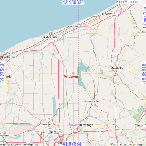
Andover GPS coordinates[2]
41° 36' 24.192" North, 80° 34' 20.28" West
| Map corner | latitude | longitude |
|---|---|---|
| Upper-left | 42.13032°, | -81.27543° |
| Center: | 41.60672°, | -80.5723° |
| Lower-right: | 41.07884°, | -79.86918° |
| Map W x H: | 116.9×116.9 km | = 72.6×72.6mi |
| max Lat: | 71.29058° ⇑28.1% North |
| Andover: | 41.60672° |
| min Lat: | ⇓71.9% South 19.06759° |
| min Long | Andover | max Long |
| -171.73463° | -80.5723° | -66.98998° |
| W 70.7%⇐ | ⇒29.3% E |
Elevation
Elevation of Andover is 333 m = 1093 ft, and this is 38.2 m = 125 ft above average elevation for this country.
| Max E: |
3189 m = 10463 ft | 22.4% |
| Andover | 333 m 1093 ft | |
| Avg. | 294.8 m = 967 ft | |
Min E: |
-60 m = -197 ft | 77.6% |
See also: United States elevation on elevation.city.
Geographical zone
Andover is located in North temperate zone (between Tropic of Cancer and the Arctic Circle). Distance of this Northern Tropic circle is 2020.3 km =1255.4 mi to South.| Distance of | km | miles | from Andover |
|---|---|---|---|
| North Pole | 5380.8 | 3343.5 | to North |
| Arctic Circle | 2774.9 | 1724.2 | to North |
| Tropic Cancer | 2020.3 | 1255.4 | to South |
| Equator | 4626.2 | 2874.6 | to South |


Nearby cities:
15 places around Andover: (largest is in red/bold)
• Austinburg
29.8 km =18.5 mi,  308°
308°
• Conneaut Lake
22.2 km =13.8 mi,  90°
90°
• Conneaut Lakeshore
21.9 km =13.6 mi,  84°
84°
• Conneautville
23.9 km =14.9 mi,  45°
45°
• Fredericksburg
33.2 km =20.6 mi, 82°
• Greenville
27.1 km =16.8 mi,  146°
146°
• Jamestown
17.6 km =10.9 mi,  140°
140°
• Jefferson
22 km =13.7 mi, 311°
• Kinsman Center
17.1 km =10.6 mi,  183°
183°
• Linesville
13.5 km =8.4 mi,  65°
65°
• Orwell
25.9 km =16.1 mi,  252°
252°
• Pymatuning Central
8.1 km =5 mi,  107°
107°
• Reynolds Heights
32.7 km =20.3 mi, 152°
• Roaming Shores
21.3 km =13.2 mi,  280°
280°
• Rock Creek
24.7 km =15.3 mi, 283°
Sources, notices
• [Note1] Compared only with cities in United States existing in our database
• [Src1] Map data: © OpenStreetMap contributors (CC-BY-SA)
• [Src2] Other city data from geonames.org with taken over terms of usage.
• [Src3] Geographical zone / Annual Mean Temperature by Robert A. Rohde @ Wikipedia
