Rock Creek geodata
Rock Creek (Ohio) is a populated place; located in United States in America/New_York (GMT-4) time zone. With population of 515 people, there are 20696 cities with bigger population in this country. Compared to other cities in United States, 72.4% of cities are located further ↓South; 69.7% of cities are located further ←West and 61% of cities have lower elevation than Rock Creek. Note1


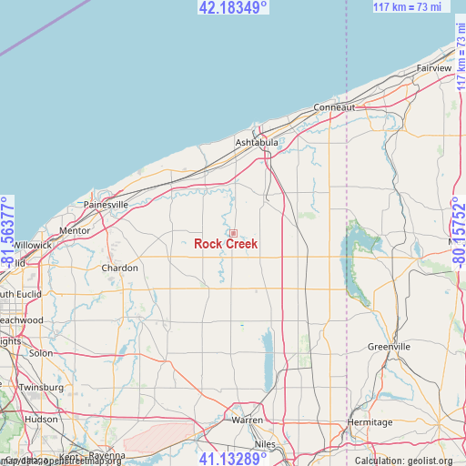
Rock Creek GPS coordinates[2]
41° 39' 37.188" North, 80° 51' 38.304" West
| Map corner | latitude | longitude |
|---|---|---|
| Upper-left | 42.18349°, | -81.56377° |
| Center: | 41.66033°, | -80.86064° |
| Lower-right: | 41.13289°, | -80.15752° |
| Map W x H: | 116.8×116.8 km | = 72.6×72.6mi |
| max Lat: | 71.29058° ⇑27.6% North |
| Rock Creek: | 41.66033° |
| min Lat: | ⇓72.4% South 19.06759° |
| min Long | Rock Creek | max Long |
| -171.73463° | -80.86064° | -66.98998° |
| W 69.7%⇐ | ⇒30.3% E |
Elevation
Elevation of Rock Creek is 244 m = 801 ft, and this is 50.8 m = 167 ft below average elevation for this country.
| Max E: |
3189 m = 10463 ft | 39% |
| Avg. | 294.8 m = 967 ft | |
| Rock Creek | 244 m = 801 ft | |
Min E: |
-60 m = -197 ft | 61% |
See also: United States elevation on elevation.city.
Geographical zone
Rock Creek is located in North temperate zone (between Tropic of Cancer and the Arctic Circle). Distance of this Northern Tropic circle is 2026.3 km =1259.1 mi to South.| Distance of | km | miles | from Rock Creek |
|---|---|---|---|
| North Pole | 5374.9 | 3339.8 | to North |
| Arctic Circle | 2769 | 1720.6 | to North |
| Tropic Cancer | 2026.3 | 1259.1 | to South |
| Equator | 4632.2 | 2878.3 | to South |


Nearby cities:
15 places around Rock Creek: (largest is in red/bold)
• Andover
24.7 km =15.3 mi,  103°
103°
• Ashtabula
23.5 km =14.6 mi,  14°
14°
• Austinburg
12.4 km =7.7 mi,  2°
2°
• Chardon
24.5 km =15.2 mi,  257°
257°
• Edgewood
24.7 km =15.3 mi,  17°
17°
• Geneva
17.7 km =11 mi,  335°
335°
• Geneva-on-the-Lake
23.5 km =14.6 mi, 340°
• Jefferson
11.5 km =7.1 mi,  40°
40°
• Madison
20 km =12.4 mi,  308°
308°
• Middlefield
28.3 km =17.6 mi,  218°
218°
• North Madison
22.2 km =13.8 mi,  315°
315°
• North Perry
27.1 km =16.8 mi, 307°
• Orwell
13.9 km =8.6 mi,  182°
182°
• Perry
25.8 km =16 mi,  295°
295°
• Roaming Shores
3.6 km =2.2 mi,  121°
121°
Sources, notices
• [Note1] Compared only with cities in United States existing in our database
• [Src1] Map data: © OpenStreetMap contributors (CC-BY-SA)
• [Src2] Other city data from geonames.org with taken over terms of usage.
• [Src3] Geographical zone / Annual Mean Temperature by Robert A. Rohde @ Wikipedia
