Butler geodata
Butler (Ohio) is a populated place; located in United States in America/New_York (GMT-4) time zone. With population of 912 people, there are 16914 cities with bigger population in this country. Compared to other cities in United States, 59.9% of cities are located further ↓South; 64.2% of cities are located further ←West and 77.1% of cities have lower elevation than Butler. Note1


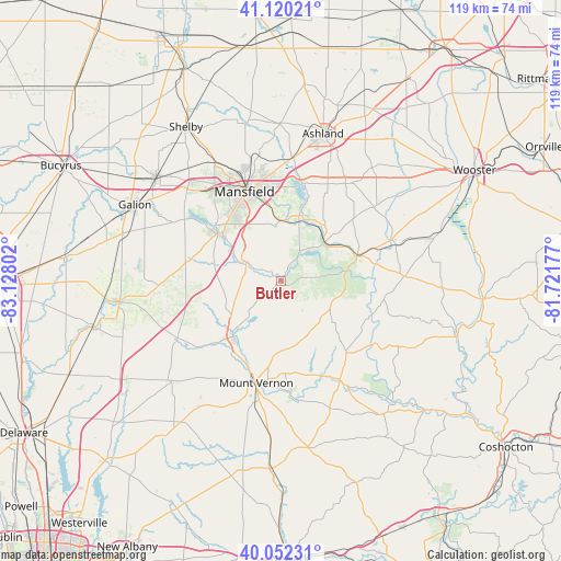
Butler GPS coordinates[2]
40° 35' 18.204" North, 82° 25' 29.604" West
| Map corner | latitude | longitude |
|---|---|---|
| Upper-left | 41.12021°, | -83.12802° |
| Center: | 40.58839°, | -82.42489° |
| Lower-right: | 40.05231°, | -81.72177° |
| Map W x H: | 118.7×118.7 km | = 73.8×73.8mi |
| max Lat: | 71.29058° ⇑40.1% North |
| Butler: | 40.58839° |
| min Lat: | ⇓59.9% South 19.06759° |
| min Long | Butler | max Long |
| -171.73463° | -82.42489° | -66.98998° |
| W 64.2%⇐ | ⇒35.8% E |
Elevation
Elevation of Butler is 328 m = 1076 ft, and this is 33.2 m = 109 ft above average elevation for this country.
| Max E: |
3189 m = 10463 ft | 22.9% |
| Butler | 328 m 1076 ft | |
| Avg. | 294.8 m = 967 ft | |
Min E: |
-60 m = -197 ft | 77.1% |
See also: United States elevation on elevation.city.
Geographical zone
Butler is located in North temperate zone (between Tropic of Cancer and the Arctic Circle). Distance of this Northern Tropic circle is 1907.1 km =1185 mi to South.| Distance of | km | miles | from Butler |
|---|---|---|---|
| North Pole | 5494.1 | 3413.9 | to North |
| Arctic Circle | 2888.2 | 1794.6 | to North |
| Tropic Cancer | 1907.1 | 1185 | to South |
| Equator | 4513 | 2804.2 | to South |


Nearby cities:
15 places around Butler: (largest is in red/bold)
• Apple Valley
17.7 km =11 mi,  160°
160°
• Bellville
8.1 km =5 mi,  295°
295°
• Danville
21 km =13 mi,  138°
138°
• Fredericktown
15.4 km =9.6 mi,  219°
219°
• Gambier
23.8 km =14.8 mi,  174°
174°
• Jeromesville
30.8 km =19.1 mi,  38°
38°
• Lexington
16.7 km =10.4 mi,  307°
307°
• Lincoln Heights
21 km =13 mi,  346°
346°
• Loudonville
17 km =10.6 mi,  72°
72°
• Lucas
13 km =8.1 mi,  2°
2°
• Mansfield
20.4 km =12.7 mi,  338°
338°
• Mount Vernon
22.3 km =13.9 mi,  193°
193°
• Oak Hill
24.8 km =15.4 mi, 141°
• Ontario
23.6 km =14.7 mi,  323°
323°
• Perrysville
12.3 km =7.6 mi,  51°
51°
Sources, notices
• [Note1] Compared only with cities in United States existing in our database
• [Src1] Map data: © OpenStreetMap contributors (CC-BY-SA)
• [Src2] Other city data from geonames.org with taken over terms of usage.
• [Src3] Geographical zone / Annual Mean Temperature by Robert A. Rohde @ Wikipedia
