Gahanna geodata
Gahanna (Ohio) is a populated place; located in United States in America/New_York (GMT-4) time zone. With population of 34,590 people, there are 1423 cities with bigger population in this country. Compared to other cities in United States, 53.8% of cities are located further ↓South; 62.3% of cities are located further ←West and 61% of cities have lower elevation than Gahanna. Note1


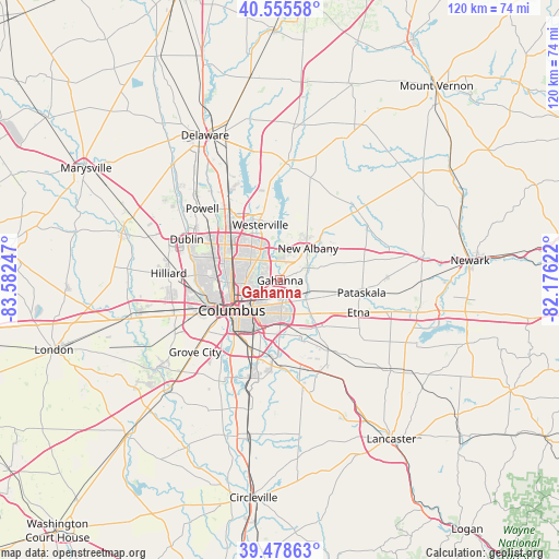
Gahanna GPS coordinates[2]
40° 1' 9.228" North, 82° 52' 45.624" West
| Map corner | latitude | longitude |
|---|---|---|
| Upper-left | 40.55558°, | -83.58247° |
| Center: | 40.01923°, | -82.87934° |
| Lower-right: | 39.47863°, | -82.17622° |
| Map W x H: | 119.7×119.7 km | = 74.4×74.4mi |
| max Lat: | 71.29058° ⇑46.2% North |
| Gahanna: | 40.01923° |
| min Lat: | ⇓53.8% South 19.06759° |
| min Long | Gahanna | max Long |
| -171.73463° | -82.87934° | -66.98998° |
| W 62.3%⇐ | ⇒37.7% E |
Elevation
Elevation of Gahanna is 244 m = 801 ft, and this is 50.8 m = 167 ft below average elevation for this country.
| Max E: |
3189 m = 10463 ft | 39% |
| Avg. | 294.8 m = 967 ft | |
| Gahanna | 244 m = 801 ft | |
Min E: |
-60 m = -197 ft | 61% |
See also: United States elevation on elevation.city.
Geographical zone
Gahanna is located in North temperate zone (between Tropic of Cancer and the Arctic Circle). Distance of this Northern Tropic circle is 1843.8 km =1145.7 mi to South.| Distance of | km | miles | from Gahanna |
|---|---|---|---|
| North Pole | 5557.3 | 3453.1 | to North |
| Arctic Circle | 2951.5 | 1834 | to North |
| Tropic Cancer | 1843.8 | 1145.7 | to South |
| Equator | 4449.7 | 2764.9 | to South |


Nearby cities:
15 places around Gahanna: (largest is in red/bold)
• Bexley
7.5 km =4.7 mi,  221°
221°
• Blacklick Estates
12.8 km =8 mi,  174°
174°
• Columbus
12.1 km =7.5 mi,  237°
237°
• Grandview Heights
14.4 km =8.9 mi,  252°
252°
• Groveport
15.7 km =9.8 mi,  181°
181°
• Huber Ridge
8.3 km =5.2 mi,  337°
337°
• Marble Cliff
15.9 km =9.9 mi,  256°
256°
• Minerva Park
8.4 km =5.2 mi,  319°
319°
• New Albany
9.1 km =5.7 mi,  41°
41°
• Reynoldsburg
9.2 km =5.7 mi,  141°
141°
• Riverlea
14.2 km =8.8 mi,  299°
299°
• Upper Arlington
15.8 km =9.8 mi, 260°
• Westerville
12.6 km =7.8 mi, 340°
• Whitehall
5.9 km =3.7 mi,  185°
185°
• Worthington
14.4 km =8.9 mi, 304°
Sources, notices
• [Note1] Compared only with cities in United States existing in our database
• [Src1] Map data: © OpenStreetMap contributors (CC-BY-SA)
• [Src2] Other city data from geonames.org with taken over terms of usage.
• [Src3] Geographical zone / Annual Mean Temperature by Robert A. Rohde @ Wikipedia
