Newburgh Heights geodata
Newburgh Heights (Ohio) is a populated place; located in United States in America/New_York (GMT-4) time zone. With population of 2,096 people, there are 11630 cities with bigger population in this country. Compared to other cities in United States, 70.3% of cities are located further ↓South; 66.8% of cities are located further ←West and 53.2% of cities have lower elevation than Newburgh Heights. Note1
Administrative division(s):
- Level 1: Ohio
- Level 2: Cuyahoga County
- Level 3: Village of Newburgh Heights


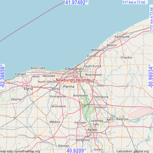
Newburgh Heights GPS coordinates[2]
41° 27' 0.18" North, 81° 39' 48.456" West
| Map corner | latitude | longitude |
|---|---|---|
| Upper-left | 41.97492°, | -82.36659° |
| Center: | 41.45005°, | -81.66346° |
| Lower-right: | 40.9209°, | -80.96034° |
| Map W x H: | 117.2×117.2 km | = 72.8×72.8mi |
| max Lat: | 71.29058° ⇑29.7% North |
| Newburgh Heights: | 41.45005° |
| min Lat: | ⇓70.3% South 19.06759° |
| min Long | Newburgh Height | max Long |
| -171.73463° | -81.66346° | -66.98998° |
| W 66.8%⇐ | ⇒33.2% E |
Elevation
Elevation of Newburgh Heights is 211 m = 692 ft, and this is 83.8 m = 275 ft below average elevation for this country.
| Max E: |
3189 m = 10463 ft | 46.8% |
| Avg. | 294.8 m = 967 ft | |
| Newburgh Heights | 211 m = 692 ft | |
Min E: |
-60 m = -197 ft | 53.2% |
See also: United States elevation on elevation.city.
Geographical zone
Newburgh Heights is located in North temperate zone (between Tropic of Cancer and the Arctic Circle). Distance of this Northern Tropic circle is 2002.9 km =1244.5 mi to South.| Distance of | km | miles | from Newburgh Heights |
|---|---|---|---|
| North Pole | 5398.2 | 3354.3 | to North |
| Arctic Circle | 2792.4 | 1735.1 | to North |
| Tropic Cancer | 2002.9 | 1244.5 | to South |
| Equator | 4608.8 | 2863.8 | to South |


Nearby cities:
15 places around Newburgh Heights: (largest is in red/bold)
• Brooklyn
6.1 km =3.8 mi,  259°
259°
• Brooklyn Heights
3.4 km =2.1 mi,  216°
216°
• Clark-Fulton
4.2 km =2.6 mi,  291°
291°
• Cleveland
6.1 km =3.8 mi,  334°
334°
• Cuyahoga Heights
1.7 km =1.1 mi,  162°
162°
• Detroit-Shoreway
6.3 km =3.9 mi,  299°
299°
• Garfield Heights
6 km =3.7 mi,  127°
127°
• Glenville
10 km =6.2 mi,  22°
22°
• Hough
7.2 km =4.5 mi, 18°
• Independence
9.3 km =5.8 mi,  166°
166°
• Maple Heights
9 km =5.6 mi,  115°
115°
• Ohio City
5.5 km =3.4 mi,  313°
313°
• Parma
7.1 km =4.4 mi, 224°
• Seven Hills
6.2 km =3.9 mi,  189°
189°
• Valley View
8.5 km =5.3 mi,  144°
144°
Sources, notices
• [Note1] Compared only with cities in United States existing in our database
• [Src1] Map data: © OpenStreetMap contributors (CC-BY-SA)
• [Src2] Other city data from geonames.org with taken over terms of usage.
• [Src3] Geographical zone / Annual Mean Temperature by Robert A. Rohde @ Wikipedia
