Prospect geodata
Prospect (Ohio) is a populated place; located in United States in America/New_York (GMT-4) time zone. With population of 1,070 people, there are 15848 cities with bigger population in this country. Compared to other cities in United States, 58.5% of cities are located further ↓South; 61.5% of cities are located further ←West and 67.8% of cities have lower elevation than Prospect. Note1


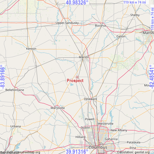
Prospect GPS coordinates[2]
40° 27' 1.224" North, 83° 11' 18.708" West
| Map corner | latitude | longitude |
|---|---|---|
| Upper-left | 40.98326°, | -83.89166° |
| Center: | 40.45034°, | -83.18853° |
| Lower-right: | 39.91316°, | -82.48541° |
| Map W x H: | 119×119 km | = 73.9×73.9mi |
| max Lat: | 71.29058° ⇑41.5% North |
| Prospect: | 40.45034° |
| min Lat: | ⇓58.5% South 19.06759° |
| min Long | Prospect | max Long |
| -171.73463° | -83.18853° | -66.98998° |
| W 61.5%⇐ | ⇒38.5% E |
Elevation
Elevation of Prospect is 275 m = 902 ft, and this is 19.8 m = 65 ft below average elevation for this country.
| Max E: |
3189 m = 10463 ft | 32.2% |
| Avg. | 294.8 m = 967 ft | |
| Prospect | 275 m = 902 ft | |
Min E: |
-60 m = -197 ft | 67.8% |
See also: United States elevation on elevation.city.
Geographical zone
Prospect is located in North temperate zone (between Tropic of Cancer and the Arctic Circle). Distance of this Northern Tropic circle is 1891.7 km =1175.4 mi to South.| Distance of | km | miles | from Prospect |
|---|---|---|---|
| North Pole | 5509.4 | 3423.4 | to North |
| Arctic Circle | 2903.5 | 1804.2 | to North |
| Tropic Cancer | 1891.7 | 1175.4 | to South |
| Equator | 4497.7 | 2794.7 | to South |


Nearby cities:
15 places around Prospect: (largest is in red/bold)
• Ashley
20.3 km =12.6 mi,  103°
103°
• Caledonia
27.8 km =17.3 mi,  41°
41°
• Cardington
25.6 km =15.9 mi,  77°
77°
• Delaware
19.7 km =12.2 mi,  148°
148°
• La Rue
21.7 km =13.5 mi,  310°
310°
• Lewis Center
31.8 km =19.8 mi, 151°
• Marion
16.2 km =10.1 mi,  18°
18°
• Marysville
28.2 km =17.5 mi,  212°
212°
• Mount Gilead
32.5 km =20.2 mi,  70°
70°
• Mount Victory
29.6 km =18.4 mi,  288°
288°
• New California
33 km =20.5 mi,  187°
187°
• Ostrander
20.6 km =12.8 mi, 185°
• Richwood
9.5 km =5.9 mi,  253°
253°
• Shawnee Hills
32.8 km =20.4 mi,  171°
171°
• West Mansfield
30.7 km =19.1 mi,  259°
259°
Sources, notices
• [Note1] Compared only with cities in United States existing in our database
• [Src1] Map data: © OpenStreetMap contributors (CC-BY-SA)
• [Src2] Other city data from geonames.org with taken over terms of usage.
• [Src3] Geographical zone / Annual Mean Temperature by Robert A. Rohde @ Wikipedia
