Rocky River geodata
Rocky River (Ohio) is a populated place; located in United States in America/New_York (GMT-4) time zone. With population of 20,376 people, there are 2465 cities with bigger population in this country. Compared to other cities in United States, 70.6% of cities are located further ↓South; 66.1% of cities are located further ←West and 53% of cities have lower elevation than Rocky River. Note1


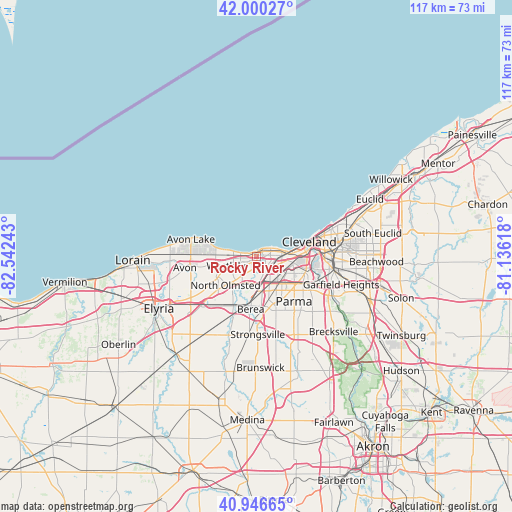
Rocky River GPS coordinates[2]
41° 28' 32.16" North, 81° 50' 21.48" West
| Map corner | latitude | longitude |
|---|---|---|
| Upper-left | 42.00027°, | -82.54243° |
| Center: | 41.4756°, | -81.8393° |
| Lower-right: | 40.94665°, | -81.13618° |
| Map W x H: | 117.2×117.1 km | = 72.8×72.8mi |
| max Lat: | 71.29058° ⇑29.4% North |
| Rocky River: | 41.4756° |
| min Lat: | ⇓70.6% South 19.06759° |
| min Long | Rocky River | max Long |
| -171.73463° | -81.8393° | -66.98998° |
| W 66.1%⇐ | ⇒33.9% E |
Elevation
Elevation of Rocky River is 210 m = 689 ft, and this is 84.8 m = 278 ft below average elevation for this country.
| Max E: |
3189 m = 10463 ft | 47% |
| Avg. | 294.8 m = 967 ft | |
| Rocky River | 210 m = 689 ft | |
Min E: |
-60 m = -197 ft | 53% |
See also: United States elevation on elevation.city.
Geographical zone
Rocky River is located in North temperate zone (between Tropic of Cancer and the Arctic Circle). Distance of this Northern Tropic circle is 2005.7 km =1246.3 mi to South.| Distance of | km | miles | from Rocky River |
|---|---|---|---|
| North Pole | 5395.4 | 3352.5 | to North |
| Arctic Circle | 2789.5 | 1733.3 | to North |
| Tropic Cancer | 2005.7 | 1246.3 | to South |
| Equator | 4611.7 | 2865.6 | to South |


Nearby cities:
15 places around Rocky River: (largest is in red/bold)
• Bay Village
7 km =4.3 mi,  278°
278°
• Berea
12.2 km =7.6 mi,  185°
185°
• Brook Park
9.1 km =5.7 mi,  161°
161°
• Brooklyn
9.5 km =5.9 mi,  114°
114°
• Clark-Fulton
10.9 km =6.8 mi,  96°
96°
• Cleveland
12.3 km =7.6 mi,  77°
77°
• Detroit-Shoreway
9.1 km =5.7 mi,  88°
88°
• Fairview Park
4.3 km =2.7 mi,  208°
208°
• Lakewood
3.5 km =2.2 mi, 78°
• North Olmsted
9.7 km =6 mi,  226°
226°
• Ohio City
10.7 km =6.6 mi, 84°
• Olmsted Falls
12.6 km =7.8 mi, 207°
• Parma
12.5 km =7.8 mi,  129°
129°
• Parma Heights
11.6 km =7.2 mi,  145°
145°
• Westlake
6.9 km =4.3 mi,  251°
251°
Sources, notices
• [Note1] Compared only with cities in United States existing in our database
• [Src1] Map data: © OpenStreetMap contributors (CC-BY-SA)
• [Src2] Other city data from geonames.org with taken over terms of usage.
• [Src3] Geographical zone / Annual Mean Temperature by Robert A. Rohde @ Wikipedia
