Monroeton geodata
Monroeton (Pennsylvania) is a populated place; located in United States in America/New_York (GMT-4) time zone. With population of 565 people, there are 20091 cities with bigger population in this country. Compared to other cities in United States, 73.1% of cities are located further ↓South; 82.7% of cities are located further ←West and 59.1% of cities have lower elevation than Monroeton. Note1
Administrative division(s):
- Level 1: Pennsylvania
- Level 2: Bradford County
- Level 3: Borough of Monroe


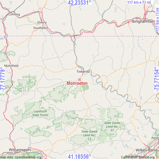
Monroeton GPS coordinates[2]
41° 42' 45.288" North, 76° 28' 28.776" West
| Map corner | latitude | longitude |
|---|---|---|
| Upper-left | 42.23531°, | -77.17779° |
| Center: | 41.71258°, | -76.47466° |
| Lower-right: | 41.18556°, | -75.77154° |
| Map W x H: | 116.7×116.7 km | = 72.5×72.5mi |
| max Lat: | 71.29058° ⇑26.9% North |
| Monroeton: | 41.71258° |
| min Lat: | ⇓73.1% South 19.06759° |
| min Long | Monroeton | max Long |
| -171.73463° | -76.47466° | -66.98998° |
| W 82.7%⇐ | ⇒17.3% E |
Elevation
Elevation of Monroeton is 236 m = 774 ft, and this is 58.8 m = 193 ft below average elevation for this country.
| Max E: |
3189 m = 10463 ft | 40.9% |
| Avg. | 294.8 m = 967 ft | |
| Monroeton | 236 m = 774 ft | |
Min E: |
-60 m = -197 ft | 59.1% |
See also: United States elevation on elevation.city.
Geographical zone
Monroeton is located in North temperate zone (between Tropic of Cancer and the Arctic Circle). Distance of this Northern Tropic circle is 2032.1 km =1262.7 mi to South.| Distance of | km | miles | from Monroeton |
|---|---|---|---|
| North Pole | 5369.1 | 3336.2 | to North |
| Arctic Circle | 2763.2 | 1717 | to North |
| Tropic Cancer | 2032.1 | 1262.7 | to South |
| Equator | 4638 | 2881.9 | to South |


Nearby cities:
15 places around Monroeton: (largest is in red/bold)
• Athens
27.4 km =17 mi,  352°
352°
• Canton
32.1 km =19.9 mi,  258°
258°
• Dushore
21.8 km =13.5 mi,  163°
163°
• Laporte
32.1 km =19.9 mi,  182°
182°
• Meshoppen
37.2 km =23.1 mi,  107°
107°
• Noxen
47.4 km =29.5 mi,  133°
133°
• Owego
46.9 km =29.1 mi,  22°
22°
• Sayre
29.8 km =18.5 mi, 353°
• South Waverly
32.1 km =19.9 mi, 350°
• Southport
47.5 km =29.5 mi,  323°
323°
• Towanda
6.7 km =4.2 mi, 23°
• Troy
27.2 km =16.9 mi,  287°
287°
• Waverly
33.4 km =20.8 mi, 352°
• Wellsburg
39.7 km =24.7 mi,  328°
328°
• Wyalusing
18.3 km =11.4 mi, 105°
Sources, notices
• [Note1] Compared only with cities in United States existing in our database
• [Src1] Map data: © OpenStreetMap contributors (CC-BY-SA)
• [Src2] Other city data from geonames.org with taken over terms of usage.
• [Src3] Geographical zone / Annual Mean Temperature by Robert A. Rohde @ Wikipedia
