Wyalusing geodata
Wyalusing (Pennsylvania) is a populated place; located in United States in America/New_York (GMT-4) time zone. With population of 572 people, there are 20007 cities with bigger population in this country. Compared to other cities in United States, 72.6% of cities are located further ↓South; 83.3% of cities are located further ←West and 54.4% of cities have lower elevation than Wyalusing. Note1
Administrative division(s):
- Level 1: Pennsylvania
- Level 2: Bradford County
- Level 3: Borough of Wyalusing


Wyalusing GPS coordinates[2]
41° 40' 5.268" North, 76° 15' 42.768" West
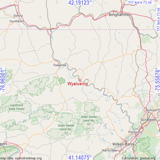
| Map corner | latitude | longitude |
|---|---|---|
| Upper-left | 42.19123°, | -76.96501° |
| Center: | 41.66813°, | -76.26188° |
| Lower-right: | 41.14075°, | -75.55876° |
| Map W x H: | 116.8×116.8 km | = 72.6×72.6mi |
| max Lat: | 71.29058° ⇑27.4% North |
| Wyalusing: | 41.66813° |
| min Lat: | ⇓72.6% South 19.06759° |
| min Long | Wyalusing | max Long |
| -171.73463° | -76.26188° | -66.98998° |
| W 83.3%⇐ | ⇒16.7% E |
Elevation
Elevation of Wyalusing is 216 m = 709 ft, and this is 78.8 m = 259 ft below average elevation for this country.
| Max E: |
3189 m = 10463 ft | 45.6% |
| Avg. | 294.8 m = 967 ft | |
| Wyalusing | 216 m = 709 ft | |
Min E: |
-60 m = -197 ft | 54.4% |
See also: United States elevation on elevation.city.
Geographical zone
Wyalusing is located in North temperate zone (between Tropic of Cancer and the Arctic Circle). Distance of this Northern Tropic circle is 2027.1 km =1259.6 mi to South.| Distance of | km | miles | from Wyalusing |
|---|---|---|---|
| North Pole | 5374 | 3339.2 | to North |
| Arctic Circle | 2768.1 | 1720 | to North |
| Tropic Cancer | 2027.1 | 1259.6 | to South |
| Equator | 4633.1 | 2878.9 | to South |


Nearby cities:
15 places around Wyalusing: (largest is in red/bold)
• Athens
38.5 km =23.9 mi,  326°
326°
• Back Mountain
43.1 km =26.8 mi,  149°
149°
• Dushore
19.7 km =12.2 mi,  215°
215°
• Factoryville
41.5 km =25.8 mi,  106°
106°
• Harveys Lake
37.3 km =23.2 mi, 148°
• Lake Winola
38.5 km =23.9 mi,  117°
117°
• Laporte
33.3 km =20.7 mi, 215°
• Meshoppen
18.9 km =11.7 mi, 108°
• Monroeton
18.3 km =11.4 mi,  285°
285°
• Montrose
36.9 km =22.9 mi,  59°
59°
• Nicholson
40.3 km =25 mi,  96°
96°
• Noxen
32.2 km =20 mi, 148°
• Sayre
40.4 km =25.1 mi, 328°
• Towanda
18.6 km =11.6 mi,  306°
306°
• Tunkhannock
29.9 km =18.6 mi, 118°
Sources, notices
• [Note1] Compared only with cities in United States existing in our database
• [Src1] Map data: © OpenStreetMap contributors (CC-BY-SA)
• [Src2] Other city data from geonames.org with taken over terms of usage.
• [Src3] Geographical zone / Annual Mean Temperature by Robert A. Rohde @ Wikipedia
