Seneca geodata
Seneca (Pennsylvania) is a populated place; located in United States in America/New_York (GMT-4) time zone. With population of 1,065 people, there are 15868 cities with bigger population in this country. Compared to other cities in United States, 69.6% of cities are located further ↓South; 74.4% of cities are located further ←West and 85.9% of cities have lower elevation than Seneca. Note1
Administrative division(s):
- Level 1: Pennsylvania
- Level 2: Venango County
- Level 3: Township of Cranberry


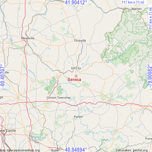
Seneca GPS coordinates[2]
41° 22' 43.212" North, 79° 42' 14.184" West
| Map corner | latitude | longitude |
|---|---|---|
| Upper-left | 41.90412°, | -80.40707° |
| Center: | 41.37867°, | -79.70394° |
| Lower-right: | 40.84894°, | -79.00082° |
| Map W x H: | 117.3×117.3 km | = 72.9×72.9mi |
| max Lat: | 71.29058° ⇑30.4% North |
| Seneca: | 41.37867° |
| min Lat: | ⇓69.6% South 19.06759° |
| min Long | Seneca | max Long |
| -171.73463° | -79.70394° | -66.98998° |
| W 74.4%⇐ | ⇒25.6% E |
Elevation
Elevation of Seneca is 443 m = 1453 ft, and this is 148.2 m = 486 ft above average elevation for this country.
| Max E: |
3189 m = 10463 ft | 14.1% |
| Seneca | 443 m 1453 ft | |
| Avg. | 294.8 m = 967 ft | |
Min E: |
-60 m = -197 ft | 85.9% |
See also: United States elevation on elevation.city.
Geographical zone
Seneca is located in North temperate zone (between Tropic of Cancer and the Arctic Circle). Distance of this Northern Tropic circle is 1995 km =1239.6 mi to South.| Distance of | km | miles | from Seneca |
|---|---|---|---|
| North Pole | 5406.2 | 3359.3 | to North |
| Arctic Circle | 2800.3 | 1740 | to North |
| Tropic Cancer | 1995 | 1239.6 | to South |
| Equator | 4600.9 | 2858.9 | to South |


Nearby cities:
15 places around Seneca: (largest is in red/bold)
• Emlenton
22.4 km =13.9 mi,  180°
180°
• Franklin
10.8 km =6.7 mi,  281°
281°
• Hasson Heights
8.1 km =5 mi,  16°
16°
• Hydetown
30.5 km =19 mi,  356°
356°
• Knox
21.2 km =13.2 mi,  139°
139°
• Marianne
27.3 km =17 mi,  122°
122°
• Oil City
6.2 km =3.9 mi, 358°
• Parker
31.5 km =19.6 mi, 176°
• Pleasantville
25.9 km =16.1 mi, 23°
• Polk
18.8 km =11.7 mi,  266°
266°
• Sandy Lake
31.7 km =19.7 mi,  263°
263°
• Sugarcreek
15.5 km =9.6 mi,  287°
287°
• Tionesta
24.4 km =15.2 mi,  57°
57°
• Titusville
27.7 km =17.2 mi,  5°
5°
• Woodland Heights
3.5 km =2.2 mi,  349°
349°
Sources, notices
• [Note1] Compared only with cities in United States existing in our database
• [Src1] Map data: © OpenStreetMap contributors (CC-BY-SA)
• [Src2] Other city data from geonames.org with taken over terms of usage.
• [Src3] Geographical zone / Annual Mean Temperature by Robert A. Rohde @ Wikipedia
