Sandy Lake geodata
Sandy Lake (Pennsylvania) is a populated place; located in United States in America/New_York (GMT-4) time zone. With population of 652 people, there are 19161 cities with bigger population in this country. Compared to other cities in United States, 69.3% of cities are located further ↓South; 72.9% of cities are located further ←West and 80.3% of cities have lower elevation than Sandy Lake. Note1
Administrative division(s):
- Level 1: Pennsylvania
- Level 2: Mercer County
- Level 3: Borough of Sandy Lake


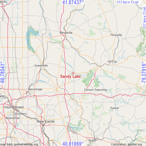
Sandy Lake GPS coordinates[2]
41° 20' 55.212" North, 80° 4' 56.208" West
| Map corner | latitude | longitude |
|---|---|---|
| Upper-left | 41.87437°, | -80.78541° |
| Center: | 41.34867°, | -80.08228° |
| Lower-right: | 40.81869°, | -79.37916° |
| Map W x H: | 117.4×117.4 km | = 72.9×72.9mi |
| max Lat: | 71.29058° ⇑30.7% North |
| Sandy Lake: | 41.34867° |
| min Lat: | ⇓69.3% South 19.06759° |
| min Long | Sandy Lake | max Long |
| -171.73463° | -80.08228° | -66.98998° |
| W 72.9%⇐ | ⇒27.1% E |
Elevation
Elevation of Sandy Lake is 356 m = 1168 ft, and this is 61.2 m = 201 ft above average elevation for this country.
| Max E: |
3189 m = 10463 ft | 19.7% |
| Sandy Lake | 356 m 1168 ft | |
| Avg. | 294.8 m = 967 ft | |
Min E: |
-60 m = -197 ft | 80.3% |
See also: United States elevation on elevation.city.
Geographical zone
Sandy Lake is located in North temperate zone (between Tropic of Cancer and the Arctic Circle). Distance of this Northern Tropic circle is 1991.6 km =1237.5 mi to South.| Distance of | km | miles | from Sandy Lake |
|---|---|---|---|
| North Pole | 5409.5 | 3361.3 | to North |
| Arctic Circle | 2803.6 | 1742.1 | to North |
| Tropic Cancer | 1991.6 | 1237.5 | to South |
| Equator | 4597.5 | 2856.8 | to South |


Nearby cities:
15 places around Sandy Lake: (largest is in red/bold)
• Clark
29.7 km =18.5 mi,  256°
256°
• Cochranton
19.3 km =12 mi,  8°
8°
• Franklin
21.6 km =13.4 mi,  75°
75°
• Greenville
26.5 km =16.5 mi,  283°
283°
• Grove City
21.2 km =13.2 mi,  181°
181°
• Harrisville
24.3 km =15.1 mi,  165°
165°
• Lake Latonka
10.5 km =6.5 mi,  231°
231°
• Mercer
18.9 km =11.7 mi,  224°
224°
• Polk
12.9 km =8 mi, 80°
• Reynolds Heights
26 km =16.2 mi,  269°
269°
• Seneca
31.7 km =19.7 mi, 83°
• Slippery Rock
31.7 km =19.7 mi, 176°
• Stoneboro
2.2 km =1.4 mi,  241°
241°
• Sugarcreek
18.6 km =11.6 mi,  64°
64°
• Woodland Heights
31.7 km =19.7 mi, 77°
Sources, notices
• [Note1] Compared only with cities in United States existing in our database
• [Src1] Map data: © OpenStreetMap contributors (CC-BY-SA)
• [Src2] Other city data from geonames.org with taken over terms of usage.
• [Src3] Geographical zone / Annual Mean Temperature by Robert A. Rohde @ Wikipedia
