Tunkhannock geodata
Tunkhannock (Pennsylvania) is a seat of a second-order administrative division; located in United States in America/New_York (GMT-4) time zone. With population of 1,780 people, there are 12625 cities with bigger population in this country. Compared to other cities in United States, 71.3% of cities are located further ↓South; 84.2% of cities are located further ←West and 52.5% of cities have higher elevation than Tunkhannock. Note1
Administrative division(s):
- Level 1: Pennsylvania
- Level 2: Wyoming County
- Level 3: Borough of Tunkhannock


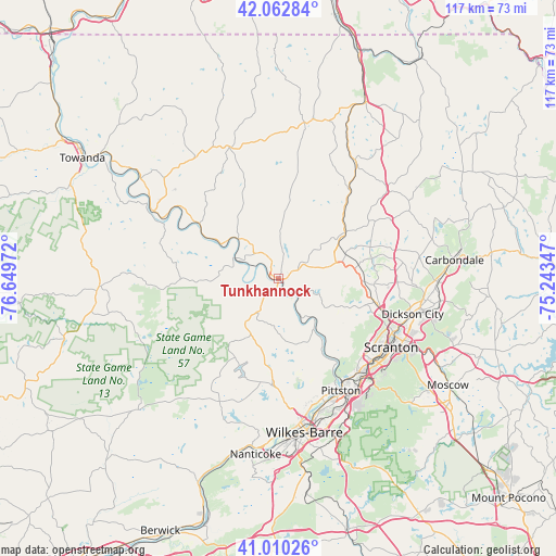
Tunkhannock GPS coordinates[2]
41° 32' 19.284" North, 75° 56' 47.724" West
| Map corner | latitude | longitude |
|---|---|---|
| Upper-left | 42.06284°, | -76.64972° |
| Center: | 41.53869°, | -75.94659° |
| Lower-right: | 41.01026°, | -75.24347° |
| Map W x H: | 117×117 km | = 72.7×72.7mi |
| max Lat: | 71.29058° ⇑28.7% North |
| Tunkhannock: | 41.53869° |
| min Lat: | ⇓71.3% South 19.06759° |
| min Long | Tunkhannock | max Long |
| -171.73463° | -75.94659° | -66.98998° |
| W 84.2%⇐ | ⇒15.8% E |
Elevation
Elevation of Tunkhannock is 189 m = 620 ft, and this is 105.8 m = 347 ft below average elevation for this country.
| Max E: |
3189 m = 10463 ft | 52.5% |
| Avg. | 294.8 m = 967 ft | |
| Tunkhannock | 189 m = 620 ft | |
Min E: |
-60 m = -197 ft | 47.5% |
See also: United States elevation on elevation.city.
Geographical zone
Tunkhannock is located in North temperate zone (between Tropic of Cancer and the Arctic Circle). Distance of this Northern Tropic circle is 2012.8 km =1250.7 mi to South.| Distance of | km | miles | from Tunkhannock |
|---|---|---|---|
| North Pole | 5388.4 | 3348.2 | to North |
| Arctic Circle | 2782.5 | 1729 | to North |
| Tropic Cancer | 2012.8 | 1250.7 | to South |
| Equator | 4618.7 | 2869.9 | to South |


Nearby cities:
15 places around Tunkhannock: (largest is in red/bold)
• Back Mountain
22.9 km =14.2 mi,  190°
190°
• Chinchilla
23.5 km =14.6 mi,  107°
107°
• Clarks Green
21.2 km =13.2 mi,  103°
103°
• Clarks Summit
20.6 km =12.8 mi, 105°
• Dallas
22.6 km =14 mi,  183°
183°
• Dalton
17.5 km =10.9 mi,  91°
91°
• Factoryville
13.9 km =8.6 mi,  78°
78°
• Glenburn
18.6 km =11.6 mi, 95°
• Harveys Lake
18.5 km =11.5 mi,  200°
200°
• Lake Winola
8.6 km =5.3 mi, 114°
• Meshoppen
11.8 km =7.3 mi,  315°
315°
• Nicholson
16.9 km =10.5 mi,  54°
54°
• Noxen
16 km =9.9 mi,  215°
215°
• Upper Exeter
17.2 km =10.7 mi,  148°
148°
• Waverly
20.1 km =12.5 mi, 93°
Sources, notices
• [Note1] Compared only with cities in United States existing in our database
• [Src1] Map data: © OpenStreetMap contributors (CC-BY-SA)
• [Src2] Other city data from geonames.org with taken over terms of usage.
• [Src3] Geographical zone / Annual Mean Temperature by Robert A. Rohde @ Wikipedia
