Huron geodata
Huron (South Dakota) is a seat of a second-order administrative division; located in United States in America/Chicago (GMT-5) time zone. With population of 13,313 people, there are 3591 cities with bigger population in this country. Compared to other cities in United States, 89.9% of cities are located further ↓South; 78.9% of cities are located further →East and 83.1% of cities have lower elevation than Huron. Note1


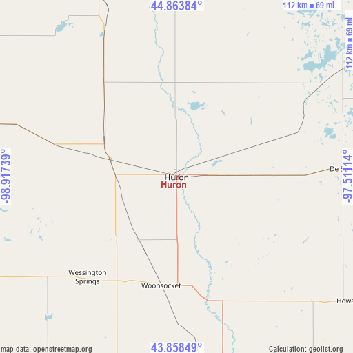
Huron GPS coordinates[2]
44° 21' 47.952" North, 98° 12' 51.336" West
| Map corner | latitude | longitude |
|---|---|---|
| Upper-left | 44.86384°, | -98.91739° |
| Center: | 44.36332°, | -98.21426° |
| Lower-right: | 43.85849°, | -97.51114° |
| Map W x H: | 111.8×111.8 km | = 69.5×69.5mi |
| max Lat: | 71.29058° ⇑10.1% North |
| Huron: | 44.36332° |
| min Lat: | ⇓89.9% South 19.06759° |
| min Long | Huron | max Long |
| -171.73463° | -98.21426° | -66.98998° |
| W 21.1%⇐ | ⇒78.9% E |
Elevation
Elevation of Huron is 392 m = 1286 ft, and this is 97.2 m = 319 ft above average elevation for this country.
| Max E: |
3189 m = 10463 ft | 16.9% |
| Huron | 392 m 1286 ft | |
| Avg. | 294.8 m = 967 ft | |
Min E: |
-60 m = -197 ft | 83.1% |
See also: United States elevation on elevation.city.
Geographical zone
Huron is located in North temperate zone (between Tropic of Cancer and the Arctic Circle). Distance of this Northern Tropic circle is 2326.8 km =1445.8 mi to South.| Distance of | km | miles | from Huron |
|---|---|---|---|
| North Pole | 5074.3 | 3153 | to North |
| Arctic Circle | 2468.4 | 1533.8 | to North |
| Tropic Cancer | 2326.8 | 1445.8 | to South |
| Equator | 4932.7 | 3065 | to South |


Nearby cities:
15 places around Huron: (largest is in red/bold)
• Alexandria
86.1 km =53.5 mi,  156°
156°
• Arlington
85.9 km =53.4 mi,  89°
89°
• Clark
68.7 km =42.7 mi,  33°
33°
• De Smet
52.8 km =32.8 mi, 87°
• Hayti
86.4 km =53.7 mi,  67°
67°
• Howard
67.4 km =41.9 mi,  125°
125°
• Kimball
90.8 km =56.4 mi,  220°
220°
• Lake Preston
66.5 km =41.3 mi, 89°
• Madison
96.3 km =59.8 mi,  114°
114°
• Miller
63.8 km =39.6 mi,  285°
285°
• Mitchell
74.2 km =46.1 mi,  168°
168°
• Plankinton
75.2 km =46.7 mi,  196°
196°
• Redfield
61.9 km =38.5 mi,  337°
337°
• Wessington Springs
42.4 km =26.3 mi, 221°
• Woonsocket
34.8 km =21.6 mi,  188°
188°
Sources, notices
• [Note1] Compared only with cities in United States existing in our database
• [Src1] Map data: © OpenStreetMap contributors (CC-BY-SA)
• [Src2] Other city data from geonames.org with taken over terms of usage.
• [Src3] Geographical zone / Annual Mean Temperature by Robert A. Rohde @ Wikipedia
