Redfield geodata
Redfield (South Dakota) is a seat of a second-order administrative division; located in United States in America/Chicago (GMT-5) time zone. With population of 2,379 people, there are 10909 cities with bigger population in this country. Compared to other cities in United States, 91.9% of cities are located further ↓South; 79.4% of cities are located further →East and 83.3% of cities have lower elevation than Redfield. Note1


Redfield GPS coordinates[2]
44° 52' 32.916" North, 98° 31' 7.356" West
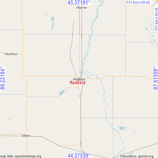
| Map corner | latitude | longitude |
|---|---|---|
| Upper-left | 45.37191°, | -99.22184° |
| Center: | 44.87581°, | -98.51871° |
| Lower-right: | 44.37539°, | -97.81559° |
| Map W x H: | 110.8×110.8 km | = 68.8×68.8mi |
| max Lat: | 71.29058° ⇑8.1% North |
| Redfield: | 44.87581° |
| min Lat: | ⇓91.9% South 19.06759° |
| min Long | Redfield | max Long |
| -171.73463° | -98.51871° | -66.98998° |
| W 20.6%⇐ | ⇒79.4% E |
Elevation
Elevation of Redfield is 395 m = 1296 ft, and this is 100.2 m = 329 ft above average elevation for this country.
| Max E: |
3189 m = 10463 ft | 16.7% |
| Redfield | 395 m 1296 ft | |
| Avg. | 294.8 m = 967 ft | |
Min E: |
-60 m = -197 ft | 83.3% |
See also: United States elevation on elevation.city.
Geographical zone
Redfield is located in North temperate zone (between Tropic of Cancer and the Arctic Circle). Distance of this Northern Tropic circle is 2383.8 km =1481.2 mi to South.| Distance of | km | miles | from Redfield |
|---|---|---|---|
| North Pole | 5017.3 | 3117.6 | to North |
| Arctic Circle | 2411.5 | 1498.4 | to North |
| Tropic Cancer | 2383.8 | 1481.2 | to South |
| Equator | 4989.7 | 3100.5 | to South |


Nearby cities:
15 places around Redfield: (largest is in red/bold)
• Aberdeen
65.5 km =40.7 mi,  2°
2°
• Clark
61.9 km =38.5 mi,  89°
89°
• De Smet
93.9 km =58.3 mi,  125°
125°
• Faulkton
50.8 km =31.6 mi,  290°
290°
• Groton
71.6 km =44.5 mi,  27°
27°
• Hayti
106.5 km =66.2 mi,  103°
103°
• Highmore
82.9 km =51.5 mi,  241°
241°
• Huron
61.9 km =38.5 mi,  157°
157°
• Ipswich
74.8 km =46.5 mi,  327°
327°
• Lake Preston
106.8 km =66.4 mi,  122°
122°
• Leola
99.8 km =62 mi,  340°
340°
• Miller
54.4 km =33.8 mi,  223°
223°
• Webster
93.4 km =58 mi,  57°
57°
• Wessington Springs
88.7 km =55.1 mi,  182°
182°
• Woonsocket
93.4 km =58 mi,  168°
168°
Sources, notices
• [Note1] Compared only with cities in United States existing in our database
• [Src1] Map data: © OpenStreetMap contributors (CC-BY-SA)
• [Src2] Other city data from geonames.org with taken over terms of usage.
• [Src3] Geographical zone / Annual Mean Temperature by Robert A. Rohde @ Wikipedia
