Yankton geodata
Yankton (South Dakota) is a seat of a second-order administrative division; located in United States in America/Chicago (GMT-5) time zone. With population of 14,557 people, there are 3323 cities with bigger population in this country. Compared to other cities in United States, 82.3% of cities are located further ↓South; 76.9% of cities are located further →East and 81.5% of cities have lower elevation than Yankton. Note1


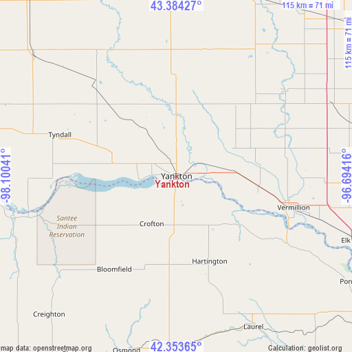
Yankton GPS coordinates[2]
42° 52' 15.996" North, 97° 23' 50.208" West
| Map corner | latitude | longitude |
|---|---|---|
| Upper-left | 43.38427°, | -98.10041° |
| Center: | 42.87111°, | -97.39728° |
| Lower-right: | 42.35365°, | -96.69416° |
| Map W x H: | 114.6×114.6 km | = 71.2×71.2mi |
| max Lat: | 71.29058° ⇑17.7% North |
| Yankton: | 42.87111° |
| min Lat: | ⇓82.3% South 19.06759° |
| min Long | Yankton | max Long |
| -171.73463° | -97.39728° | -66.98998° |
| W 23.1%⇐ | ⇒76.9% E |
Elevation
Elevation of Yankton is 370 m = 1214 ft, and this is 75.2 m = 247 ft above average elevation for this country.
| Max E: |
3189 m = 10463 ft | 18.5% |
| Yankton | 370 m 1214 ft | |
| Avg. | 294.8 m = 967 ft | |
Min E: |
-60 m = -197 ft | 81.5% |
See also: United States elevation on elevation.city.
Geographical zone
Yankton is located in North temperate zone (between Tropic of Cancer and the Arctic Circle). Distance of this Northern Tropic circle is 2160.9 km =1342.7 mi to South.| Distance of | km | miles | from Yankton |
|---|---|---|---|
| North Pole | 5240.2 | 3256.1 | to North |
| Arctic Circle | 2634.4 | 1636.9 | to North |
| Tropic Cancer | 2160.9 | 1342.7 | to South |
| Equator | 4766.8 | 2962 | to South |


Nearby cities:
15 places around Yankton: (largest is in red/bold)
• Bloomfield
36.4 km =22.6 mi,  213°
213°
• Center
48.8 km =30.3 mi,  233°
233°
• Centerville
44.9 km =27.9 mi,  52°
52°
• Crofton
17.7 km =11 mi, 206°
• Freeman
53.6 km =33.3 mi,  356°
356°
• Hartington
29.7 km =18.5 mi,  158°
158°
• Menno
43.5 km =27 mi,  340°
340°
• Olivet
46.9 km =29.1 mi,  331°
331°
• Randolph
54.9 km =34.1 mi,  176°
176°
• Scotland
40.5 km =25.2 mi,  319°
319°
• Springfield
40.8 km =25.4 mi,  267°
267°
• Tyndall
40.3 km =25 mi,  289°
289°
• Vermillion
39.5 km =24.5 mi,  104°
104°
• Viborg
42 km =26.1 mi,  37°
37°
• Wausa
43 km =26.7 mi,  195°
195°
Sources, notices
• [Note1] Compared only with cities in United States existing in our database
• [Src1] Map data: © OpenStreetMap contributors (CC-BY-SA)
• [Src2] Other city data from geonames.org with taken over terms of usage.
• [Src3] Geographical zone / Annual Mean Temperature by Robert A. Rohde @ Wikipedia
