Independence geodata
Independence (Wisconsin) is a populated place; located in United States in America/Chicago (GMT-5) time zone. With population of 1,341 people, there are 14386 cities with bigger population in this country. Compared to other cities in United States, 89.9% of cities are located further ↓South; 62.9% of cities are located further →East and 59.9% of cities have lower elevation than Independence. Note1
Administrative division(s):
- Level 1: Wisconsin
- Level 2: Trempealeau County
- Level 3: City of Independence


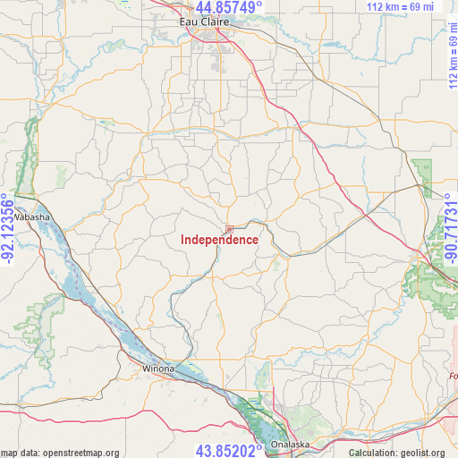
Independence GPS coordinates[2]
44° 21' 24.876" North, 91° 25' 13.548" West
| Map corner | latitude | longitude |
|---|---|---|
| Upper-left | 44.85749°, | -92.12356° |
| Center: | 44.35691°, | -91.42043° |
| Lower-right: | 43.85202°, | -90.71731° |
| Map W x H: | 111.8×111.8 km | = 69.5×69.5mi |
| max Lat: | 71.29058° ⇑10.1% North |
| Independence: | 44.35691° |
| min Lat: | ⇓89.9% South 19.06759° |
| min Long | Independence | max Long |
| -171.73463° | -91.42043° | -66.98998° |
| W 37.1%⇐ | ⇒62.9% E |
Elevation
Elevation of Independence is 239 m = 784 ft, and this is 55.8 m = 183 ft below average elevation for this country.
| Max E: |
3189 m = 10463 ft | 40.1% |
| Avg. | 294.8 m = 967 ft | |
| Independence | 239 m = 784 ft | |
Min E: |
-60 m = -197 ft | 59.9% |
See also: United States elevation on elevation.city.
Geographical zone
Independence is located in North temperate zone (between Tropic of Cancer and the Arctic Circle). Distance of this Northern Tropic circle is 2326.1 km =1445.4 mi to South.| Distance of | km | miles | from Independence |
|---|---|---|---|
| North Pole | 5075 | 3153.5 | to North |
| Arctic Circle | 2469.1 | 1534.2 | to North |
| Tropic Cancer | 2326.1 | 1445.4 | to South |
| Equator | 4932 | 3064.6 | to South |


Nearby cities:
15 places around Independence: (largest is in red/bold)
• Alma
39.5 km =24.5 mi,  264°
264°
• Arcadia
13.3 km =8.3 mi,  209°
209°
• Blair
16.3 km =10.1 mi,  115°
115°
• Buffalo City
38 km =23.6 mi,  248°
248°
• Eleva
24.7 km =15.3 mi,  350°
350°
• Ettrick
24.2 km =15 mi,  150°
150°
• Fountain City
34.5 km =21.4 mi,  223°
223°
• Galesville
31.1 km =19.3 mi,  169°
169°
• Goodview
39.4 km =24.5 mi, 213°
• Mondovi
30.7 km =19.1 mi,  319°
319°
• Osseo
28.4 km =17.6 mi,  32°
32°
• Strum
21.5 km =13.4 mi,  5°
5°
• Trempealeau
39.1 km =24.3 mi,  182°
182°
• Whitehall
8.3 km =5.2 mi,  81°
81°
• Winona
38.3 km =23.8 mi, 207°
Sources, notices
• [Note1] Compared only with cities in United States existing in our database
• [Src1] Map data: © OpenStreetMap contributors (CC-BY-SA)
• [Src2] Other city data from geonames.org with taken over terms of usage.
• [Src3] Geographical zone / Annual Mean Temperature by Robert A. Rohde @ Wikipedia
