Trempealeau geodata
Trempealeau (Wisconsin) is a populated place; located in United States in America/Chicago (GMT-5) time zone. With population of 1,615 people, there are 13239 cities with bigger population in this country. Compared to other cities in United States, 88.4% of cities are located further ↓South; 63% of cities are located further →East and 53.7% of cities have lower elevation than Trempealeau. Note1
Administrative division(s):
- Level 1: Wisconsin
- Level 2: Trempealeau County
- Level 3: Village of Trempealeau


Trempealeau GPS coordinates[2]
44° 0' 19.872" North, 91° 26' 31.524" West
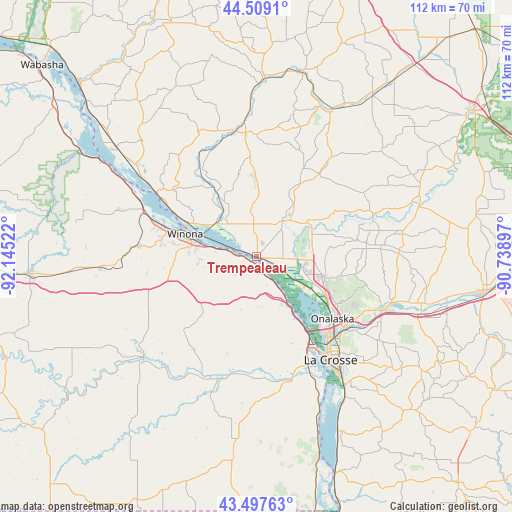
| Map corner | latitude | longitude |
|---|---|---|
| Upper-left | 44.5091°, | -92.14522° |
| Center: | 44.00552°, | -91.44209° |
| Lower-right: | 43.49763°, | -90.73897° |
| Map W x H: | 112.5×112.5 km | = 69.9×69.9mi |
| max Lat: | 71.29058° ⇑11.6% North |
| Trempealeau: | 44.00552° |
| min Lat: | ⇓88.4% South 19.06759° |
| min Long | Trempealeau | max Long |
| -171.73463° | -91.44209° | -66.98998° |
| W 37%⇐ | ⇒63% E |
Elevation
Elevation of Trempealeau is 213 m = 699 ft, and this is 81.8 m = 268 ft below average elevation for this country.
| Max E: |
3189 m = 10463 ft | 46.3% |
| Avg. | 294.8 m = 967 ft | |
| Trempealeau | 213 m = 699 ft | |
Min E: |
-60 m = -197 ft | 53.7% |
See also: United States elevation on elevation.city.
Geographical zone
Trempealeau is located in North temperate zone (between Tropic of Cancer and the Arctic Circle). Distance of this Northern Tropic circle is 2287 km =1421.1 mi to South.| Distance of | km | miles | from Trempealeau |
|---|---|---|---|
| North Pole | 5114.1 | 3177.8 | to North |
| Arctic Circle | 2508.2 | 1558.5 | to North |
| Tropic Cancer | 2287 | 1421.1 | to South |
| Equator | 4893 | 3040.4 | to South |


Nearby cities:
15 places around Trempealeau: (largest is in red/bold)
• Arcadia
27.9 km =17.3 mi,  350°
350°
• Brice Prairie
13.6 km =8.5 mi,  123°
123°
• Ettrick
22.8 km =14.2 mi,  37°
37°
• Fountain City
26.2 km =16.3 mi,  302°
302°
• French Island
21.9 km =13.6 mi,  138°
138°
• Galesville
11.3 km =7 mi, 41°
• Goodview
21.2 km =13.2 mi,  287°
287°
• Hokah
28.4 km =17.6 mi,  164°
164°
• Holmen
15.6 km =9.7 mi,  107°
107°
• La Crescent
22.6 km =14 mi,  150°
150°
• La Crosse
27.9 km =17.3 mi, 144°
• North La Crosse
23.5 km =14.6 mi, 138°
• Onalaska
21.4 km =13.3 mi,  129°
129°
• Stockton
26.3 km =16.3 mi,  275°
275°
• Winona
16.5 km =10.3 mi, 287°
Sources, notices
• [Note1] Compared only with cities in United States existing in our database
• [Src1] Map data: © OpenStreetMap contributors (CC-BY-SA)
• [Src2] Other city data from geonames.org with taken over terms of usage.
• [Src3] Geographical zone / Annual Mean Temperature by Robert A. Rohde @ Wikipedia
