Fountain City geodata
Fountain City (Wisconsin) is a populated place; located in United States in America/Chicago (GMT-5) time zone. With population of 848 people, there are 17383 cities with bigger population in this country. Compared to other cities in United States, 88.9% of cities are located further ↓South; 63.5% of cities are located further →East and 50.5% of cities have lower elevation than Fountain City. Note1
Administrative division(s):
- Level 1: Wisconsin
- Level 2: Buffalo County
- Level 3: City of Fountain City


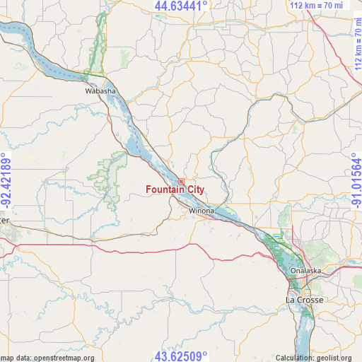
Fountain City GPS coordinates[2]
44° 7' 54.876" North, 91° 43' 7.536" West
| Map corner | latitude | longitude |
|---|---|---|
| Upper-left | 44.63441°, | -92.42189° |
| Center: | 44.13191°, | -91.71876° |
| Lower-right: | 43.62509°, | -91.01564° |
| Map W x H: | 112.2×112.2 km | = 69.7×69.7mi |
| max Lat: | 71.29058° ⇑11.1% North |
| Fountain City: | 44.13191° |
| min Lat: | ⇓88.9% South 19.06759° |
| min Long | Fountain City | max Long |
| -171.73463° | -91.71876° | -66.98998° |
| W 36.5%⇐ | ⇒63.5% E |
Elevation
Elevation of Fountain City is 200 m = 656 ft, and this is 94.8 m = 311 ft below average elevation for this country.
| Max E: |
3189 m = 10463 ft | 49.5% |
| Avg. | 294.8 m = 967 ft | |
| Fountain City | 200 m = 656 ft | |
Min E: |
-60 m = -197 ft | 50.5% |
See also: United States elevation on elevation.city.
Geographical zone
Fountain City is located in North temperate zone (between Tropic of Cancer and the Arctic Circle). Distance of this Northern Tropic circle is 2301.1 km =1429.8 mi to South.| Distance of | km | miles | from Fountain City |
|---|---|---|---|
| North Pole | 5100.1 | 3169.1 | to North |
| Arctic Circle | 2494.2 | 1549.8 | to North |
| Tropic Cancer | 2301.1 | 1429.8 | to South |
| Equator | 4907 | 3049.1 | to South |


Nearby cities:
15 places around Fountain City: (largest is in red/bold)
• Alma
26.1 km =16.2 mi,  323°
323°
• Arcadia
21.9 km =13.6 mi,  52°
52°
• Buffalo City
16 km =9.9 mi,  313°
313°
• Ettrick
36.1 km =22.4 mi,  83°
83°
• Galesville
30 km =18.6 mi,  100°
100°
• Goodview
7.9 km =4.9 mi,  166°
166°
• Independence
34.5 km =21.4 mi,  43°
43°
• Lewiston
20.3 km =12.6 mi,  216°
216°
• Plainview
36.3 km =22.6 mi,  275°
275°
• Rollingstone
8.7 km =5.4 mi,  244°
244°
• Rushford
36.1 km =22.4 mi,  184°
184°
• Saint Charles
33 km =20.5 mi, 236°
• Stockton
12.3 km =7.6 mi,  199°
199°
• Trempealeau
26.2 km =16.3 mi,  122°
122°
• Winona
11.1 km =6.9 mi,  145°
145°
Sources, notices
• [Note1] Compared only with cities in United States existing in our database
• [Src1] Map data: © OpenStreetMap contributors (CC-BY-SA)
• [Src2] Other city data from geonames.org with taken over terms of usage.
• [Src3] Geographical zone / Annual Mean Temperature by Robert A. Rohde @ Wikipedia
