Schofield geodata
Schofield (Wisconsin) is a populated place; located in United States in America/Chicago (GMT-5) time zone. With population of 2,203 people, there are 11334 cities with bigger population in this country. Compared to other cities in United States, 92.1% of cities are located further ↓South; 57.8% of cities are located further →East and 81.2% of cities have lower elevation than Schofield. Note1


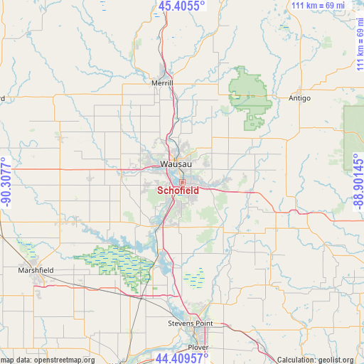
Schofield GPS coordinates[2]
44° 54' 34.884" North, 89° 36' 16.452" West
| Map corner | latitude | longitude |
|---|---|---|
| Upper-left | 45.4055°, | -90.3077° |
| Center: | 44.90969°, | -89.60457° |
| Lower-right: | 44.40957°, | -88.90145° |
| Map W x H: | 110.7×110.7 km | = 68.8×68.8mi |
| max Lat: | 71.29058° ⇑7.9% North |
| Schofield: | 44.90969° |
| min Lat: | ⇓92.1% South 19.06759° |
| min Long | Schofield | max Long |
| -171.73463° | -89.60457° | -66.98998° |
| W 42.2%⇐ | ⇒57.8% E |
Elevation
Elevation of Schofield is 367 m = 1204 ft, and this is 72.2 m = 237 ft above average elevation for this country.
| Max E: |
3189 m = 10463 ft | 18.8% |
| Schofield | 367 m 1204 ft | |
| Avg. | 294.8 m = 967 ft | |
Min E: |
-60 m = -197 ft | 81.2% |
See also: United States elevation on elevation.city.
Geographical zone
Schofield is located in North temperate zone (between Tropic of Cancer and the Arctic Circle). Distance of this Northern Tropic circle is 2387.6 km =1483.6 mi to South.| Distance of | km | miles | from Schofield |
|---|---|---|---|
| North Pole | 5013.6 | 3115.3 | to North |
| Arctic Circle | 2407.7 | 1496.1 | to North |
| Tropic Cancer | 2387.6 | 1483.6 | to South |
| Equator | 4993.5 | 3102.8 | to South |


Nearby cities:
15 places around Schofield: (largest is in red/bold)
• Bevent
23 km =14.3 mi,  132°
132°
• Birnamwood
31.2 km =19.4 mi,  85°
85°
• Edgar
28.3 km =17.6 mi,  273°
273°
• Evergreen
7.9 km =4.9 mi,  199°
199°
• Hatley
21.1 km =13.1 mi,  96°
96°
• Kronenwetter
9.8 km =6.1 mi,  173°
173°
• Maine
14.7 km =9.1 mi,  332°
332°
• Marathon
18.7 km =11.6 mi,  276°
276°
• Merrill
30.7 km =19.1 mi,  348°
348°
• Mosinee
15.1 km =9.4 mi,  210°
210°
• Rib Mountain
5.6 km =3.5 mi, 273°
• Rothschild
2.8 km =1.7 mi, 206°
• Wausau
5.9 km =3.7 mi,  339°
339°
• Weston
5 km =3.1 mi,  115°
115°
• Wittenberg
35.5 km =22.1 mi, 104°
Sources, notices
• [Note1] Compared only with cities in United States existing in our database
• [Src1] Map data: © OpenStreetMap contributors (CC-BY-SA)
• [Src2] Other city data from geonames.org with taken over terms of usage.
• [Src3] Geographical zone / Annual Mean Temperature by Robert A. Rohde @ Wikipedia
