La Paz Valley geodata
La Paz Valley (Arizona) is a section of populated place; located in United States in America/Phoenix (GMT-7) time zone. With population of 699 people, there are 18689 cities with bigger population in this country. Compared to other cities in United States, 82.8% of cities are located further ↑North; 88.6% of cities are located further →East and 74.7% of cities have lower elevation than La Paz Valley. Note1


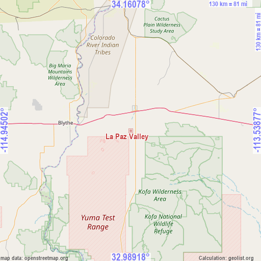
La Paz Valley GPS coordinates[2]
33° 34' 37.092" North, 114° 14' 30.804" West
| Map corner | latitude | longitude |
|---|---|---|
| Upper-left | 34.16078°, | -114.94502° |
| Center: | 33.57697°, | -114.24189° |
| Lower-right: | 32.98918°, | -113.53877° |
| Map W x H: | 130.3×130.3 km | = 81×81mi |
| max Lat: | 71.29058° ⇑82.8% North |
| La Paz Valley: | 33.57697° |
| min Lat: | ⇓17.2% South 19.06759° |
| min Long | La Paz Valley | max Long |
| -171.73463° | -114.24189° | -66.98998° |
| W 11.4%⇐ | ⇒88.6% E |
Elevation
Elevation of La Paz Valley is 311 m = 1020 ft, and this is 16.2 m = 53 ft above average elevation for this country.
| Max E: |
3189 m = 10463 ft | 25.3% |
| La Paz Valley | 311 m 1020 ft | |
| Avg. | 294.8 m = 967 ft | |
Min E: |
-60 m = -197 ft | 74.7% |
See also: United States elevation on elevation.city.
Geographical zone
La Paz Valley is located in North temperate zone (between Tropic of Cancer and the Arctic Circle). Distance of this Northern Tropic circle is 1127.5 km =700.6 mi to South.| Distance of | km | miles | from La Paz Valley |
|---|---|---|---|
| North Pole | 6273.7 | 3898.3 | to North |
| Arctic Circle | 3667.8 | 2279.1 | to North |
| Tropic Cancer | 1127.5 | 700.6 | to South |
| Equator | 3733.4 | 2319.8 | to South |


Nearby cities:
15 places around La Paz Valley: (largest is in red/bold)
• Big River
63.6 km =39.5 mi,  350°
350°
• Bluewater
65.8 km =40.9 mi,  358°
358°
• Blythe
33 km =20.5 mi,  276°
276°
• Bouse
45.2 km =28.1 mi,  28°
28°
• Brenda
29.8 km =18.5 mi,  67°
67°
• Cienega Springs
68 km =42.3 mi,  1°
1°
• Ehrenberg
26.4 km =16.4 mi, 276°
• Mesa Verde
45.4 km =28.2 mi,  274°
274°
• Parker
63.9 km =39.7 mi, 356°
• Parker Strip
71.5 km =44.4 mi, 3°
• Quartzsite
9.7 km =6 mi,  6°
6°
• Ripley
38.8 km =24.1 mi,  261°
261°
• Salome
62.3 km =38.7 mi, 68°
• Vicksburg
49 km =30.4 mi, 67°
• Wenden
70.3 km =43.7 mi, 67°
Sources, notices
• [Note1] Compared only with cities in United States existing in our database
• [Src1] Map data: © OpenStreetMap contributors (CC-BY-SA)
• [Src2] Other city data from geonames.org with taken over terms of usage.
• [Src3] Geographical zone / Annual Mean Temperature by Robert A. Rohde @ Wikipedia
