Crockett geodata
Crockett (California) is a populated place; located in United States in America/Los_Angeles (GMT-7) time zone. With population of 3,094 people, there are 9469 cities with bigger population in this country. Compared to other cities in United States, 61.3% of cities are located further ↑North; 95.7% of cities are located further →East and 81.8% of cities have higher elevation than Crockett. Note1


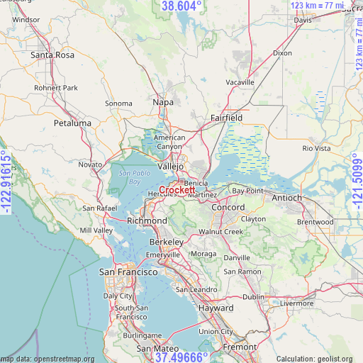
Crockett GPS coordinates[2]
38° 3' 8.712" North, 122° 12' 46.872" West
| Map corner | latitude | longitude |
|---|---|---|
| Upper-left | 38.604°, | -122.91615° |
| Center: | 38.05242°, | -122.21302° |
| Lower-right: | 37.49666°, | -121.5099° |
| Map W x H: | 123.1×123.1 km | = 76.5×76.5mi |
| max Lat: | 71.29058° ⇑61.3% North |
| Crockett: | 38.05242° |
| min Lat: | ⇓38.7% South 19.06759° |
| min Long | Crockett | max Long |
| -171.73463° | -122.21302° | -66.98998° |
| W 4.3%⇐ | ⇒95.7% E |
Elevation
Elevation of Crockett is 39 m = 128 ft, and this is 255.8 m = 839 ft below average elevation for this country.
| Max E: |
3189 m = 10463 ft | 81.8% |
| Avg. | 294.8 m = 967 ft | |
| Crockett | 39 m = 128 ft | |
Min E: |
-60 m = -197 ft | 18.2% |
See also: United States elevation on elevation.city.
Geographical zone
Crockett is located in North temperate zone (between Tropic of Cancer and the Arctic Circle). Distance of this Northern Tropic circle is 1625.1 km =1009.8 mi to South.| Distance of | km | miles | from Crockett |
|---|---|---|---|
| North Pole | 5776 | 3589 | to North |
| Arctic Circle | 3170.1 | 1969.8 | to North |
| Tropic Cancer | 1625.1 | 1009.8 | to South |
| Equator | 4231 | 2629 | to South |


Nearby cities:
15 places around Crockett: (largest is in red/bold)
• American Canyon
14.2 km =8.8 mi,  342°
342°
• Bayview
10.5 km =6.5 mi,  241°
241°
• Benicia
4.8 km =3 mi,  94°
94°
• El Sobrante
11 km =6.8 mi,  220°
220°
• Hercules
7.7 km =4.8 mi, 239°
• Martinez
7.8 km =4.8 mi,  118°
118°
• Montalvin
12.3 km =7.6 mi, 238°
• Mountain View
9.7 km =6 mi, 120°
• Pacheco
14.3 km =8.9 mi, 122°
• Pinole
9.2 km =5.7 mi,  234°
234°
• Rodeo
5.2 km =3.2 mi,  245°
245°
• Rollingwood
14.1 km =8.8 mi, 226°
• Tara Hills
11.2 km =7 mi, 234°
• Vallejo
6.9 km =4.3 mi,  326°
326°
• Vine Hill
11.3 km =7 mi, 115°
Sources, notices
• [Note1] Compared only with cities in United States existing in our database
• [Src1] Map data: © OpenStreetMap contributors (CC-BY-SA)
• [Src2] Other city data from geonames.org with taken over terms of usage.
• [Src3] Geographical zone / Annual Mean Temperature by Robert A. Rohde @ Wikipedia
