San Ardo geodata
San Ardo (California) is a populated place; located in United States in America/Los_Angeles (GMT-7) time zone. With population of 517 people, there are 20672 cities with bigger population in this country. Compared to other cities in United States, 70.4% of cities are located further ↑North; 93.7% of cities are located further →East and 63.1% of cities have higher elevation than San Ardo. Note1


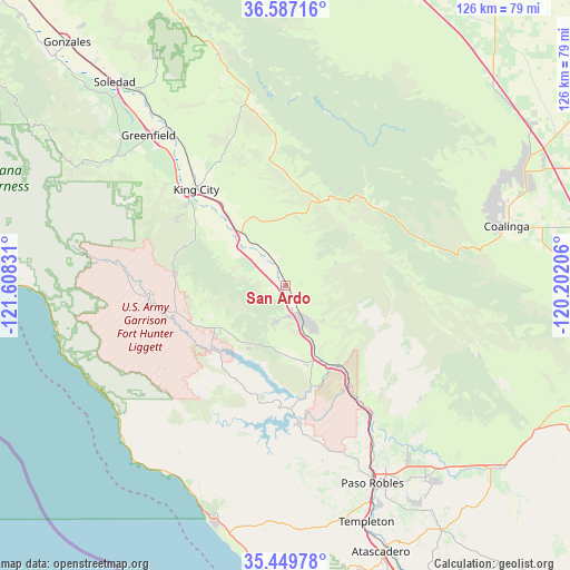
San Ardo GPS coordinates[2]
36° 1' 13.872" North, 120° 54' 18.648" West
| Map corner | latitude | longitude |
|---|---|---|
| Upper-left | 36.58716°, | -121.60831° |
| Center: | 36.02052°, | -120.90518° |
| Lower-right: | 35.44978°, | -120.20206° |
| Map W x H: | 126.5×126.5 km | = 78.6×78.6mi |
| max Lat: | 71.29058° ⇑70.4% North |
| San Ardo: | 36.02052° |
| min Lat: | ⇓29.6% South 19.06759° |
| min Long | San Ardo | max Long |
| -171.73463° | -120.90518° | -66.98998° |
| W 6.3%⇐ | ⇒93.7% E |
Elevation
Elevation of San Ardo is 138 m = 453 ft, and this is 156.8 m = 514 ft below average elevation for this country.
| Max E: |
3189 m = 10463 ft | 63.1% |
| Avg. | 294.8 m = 967 ft | |
| San Ardo | 138 m = 453 ft | |
Min E: |
-60 m = -197 ft | 36.9% |
See also: United States elevation on elevation.city.
Geographical zone
San Ardo is located in North temperate zone (between Tropic of Cancer and the Arctic Circle). Distance of this Northern Tropic circle is 1399.2 km =869.4 mi to South.| Distance of | km | miles | from San Ardo |
|---|---|---|---|
| North Pole | 6002 | 3729.5 | to North |
| Arctic Circle | 3396.1 | 2110.2 | to North |
| Tropic Cancer | 1399.2 | 869.4 | to South |
| Equator | 4005.1 | 2488.7 | to South |


Nearby cities:
15 places around San Ardo: (largest is in red/bold)
• Atascadero
62.7 km =39 mi,  160°
160°
• Avenal
69.8 km =43.4 mi,  91°
91°
• Cambria
53.2 km =33.1 mi,  197°
197°
• Cayucos
64.3 km =40 mi,  178°
178°
• Coalinga
50.7 km =31.5 mi,  74°
74°
• Gonzales
72.5 km =45 mi,  318°
318°
• Greenfield
45.2 km =28.1 mi, 317°
• King City
29.2 km =18.1 mi, 317°
• Lake Nacimiento
32.6 km =20.3 mi, 175°
• Morro Bay
73 km =45.4 mi, 176°
• Paso Robles
47.9 km =29.8 mi, 156°
• San Miguel
35.2 km =21.9 mi,  147°
147°
• Shandon
62.7 km =39 mi,  130°
130°
• Soledad
58.7 km =36.5 mi, 319°
• Templeton
55.3 km =34.4 mi, 161°
Sources, notices
• [Note1] Compared only with cities in United States existing in our database
• [Src1] Map data: © OpenStreetMap contributors (CC-BY-SA)
• [Src2] Other city data from geonames.org with taken over terms of usage.
• [Src3] Geographical zone / Annual Mean Temperature by Robert A. Rohde @ Wikipedia
