Thermalito geodata
Thermalito (California) is a populated place; located in United States in America/Los_Angeles (GMT-7) time zone. With population of 6,646 people, there are 6028 cities with bigger population in this country. Compared to other cities in United States, 50.8% of cities are located further ↑North; 94.4% of cities are located further →East and 75.8% of cities have higher elevation than Thermalito. Note1


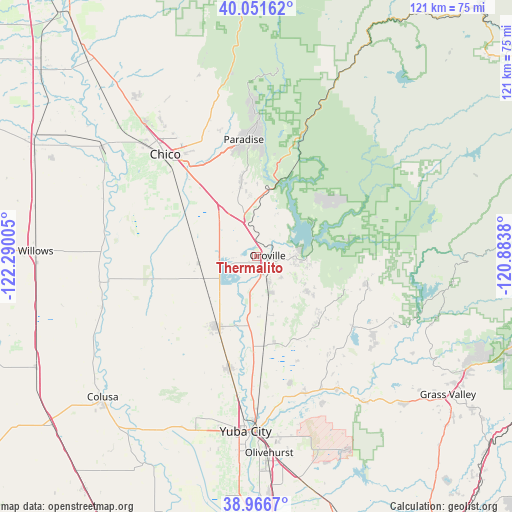
Thermalito GPS coordinates[2]
39° 30' 40.608" North, 121° 35' 12.912" West
| Map corner | latitude | longitude |
|---|---|---|
| Upper-left | 40.05162°, | -122.29005° |
| Center: | 39.51128°, | -121.58692° |
| Lower-right: | 38.9667°, | -120.8838° |
| Map W x H: | 120.6×120.6 km | = 74.9×74.9mi |
| max Lat: | 71.29058° ⇑50.8% North |
| Thermalito: | 39.51128° |
| min Lat: | ⇓49.2% South 19.06759° |
| min Long | Thermalito | max Long |
| -171.73463° | -121.58692° | -66.98998° |
| W 5.6%⇐ | ⇒94.4% E |
Elevation
Elevation of Thermalito is 67 m = 220 ft, and this is 227.8 m = 747 ft below average elevation for this country.
| Max E: |
3189 m = 10463 ft | 75.8% |
| Avg. | 294.8 m = 967 ft | |
| Thermalito | 67 m = 220 ft | |
Min E: |
-60 m = -197 ft | 24.2% |
See also: United States elevation on elevation.city.
Geographical zone
Thermalito is located in North temperate zone (between Tropic of Cancer and the Arctic Circle). Distance of this Northern Tropic circle is 1787.3 km =1110.6 mi to South.| Distance of | km | miles | from Thermalito |
|---|---|---|---|
| North Pole | 5613.8 | 3488.3 | to North |
| Arctic Circle | 3007.9 | 1869 | to North |
| Tropic Cancer | 1787.3 | 1110.6 | to South |
| Equator | 4393.2 | 2729.8 | to South |


Nearby cities:
15 places around Thermalito: (largest is in red/bold)
• Bangor
20.7 km =12.9 mi,  131°
131°
• Berry Creek
21.7 km =13.5 mi,  46°
46°
• Biggs
15.4 km =9.6 mi,  224°
224°
• Challenge-Brownsville
28.2 km =17.5 mi,  100°
100°
• Chico
32.3 km =20.1 mi,  318°
318°
• Concow
24.9 km =15.5 mi,  11°
11°
• Durham
23.6 km =14.7 mi,  309°
309°
• Gridley
18.8 km =11.7 mi,  209°
209°
• Live Oak
26.9 km =16.7 mi,  193°
193°
• Loma Rica
26.5 km =16.5 mi,  146°
146°
• Oroville
2.5 km =1.6 mi,  83°
83°
• Oroville East
9.6 km =6 mi,  90°
90°
• Palermo
9.4 km =5.8 mi, 153°
• Paradise
27.8 km =17.3 mi,  353°
353°
• South Oroville
3.4 km =2.1 mi,  118°
118°
Sources, notices
• [Note1] Compared only with cities in United States existing in our database
• [Src1] Map data: © OpenStreetMap contributors (CC-BY-SA)
• [Src2] Other city data from geonames.org with taken over terms of usage.
• [Src3] Geographical zone / Annual Mean Temperature by Robert A. Rohde @ Wikipedia
