Wofford Heights geodata
Wofford Heights (California) is a populated place; located in United States in America/Los_Angeles (GMT-7) time zone. With population of 2,200 people, there are 11341 cities with bigger population in this country. Compared to other cities in United States, 71.8% of cities are located further ↑North; 91.6% of cities are located further →East and 92.2% of cities have lower elevation than Wofford Heights. Note1


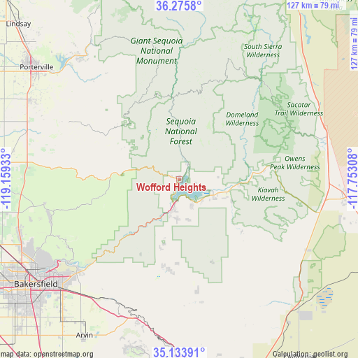
Wofford Heights GPS coordinates[2]
35° 42' 24.84" North, 118° 27' 22.32" West
| Map corner | latitude | longitude |
|---|---|---|
| Upper-left | 36.2758°, | -119.15933° |
| Center: | 35.7069°, | -118.4562° |
| Lower-right: | 35.13391°, | -117.75308° |
| Map W x H: | 127×127 km | = 78.9×78.9mi |
| max Lat: | 71.29058° ⇑71.8% North |
| Wofford Heights: | 35.7069° |
| min Lat: | ⇓28.2% South 19.06759° |
| min Long | Wofford Heights | max Long |
| -171.73463° | -118.4562° | -66.98998° |
| W 8.4%⇐ | ⇒91.6% E |
Elevation
Elevation of Wofford Heights is 817 m = 2680 ft, and this is 522.2 m = 1713 ft above average elevation for this country.
| Max E: |
3189 m = 10463 ft | 7.8% |
| Wofford Heights | 817 m 2680 ft | |
| Avg. | 294.8 m = 967 ft | |
Min E: |
-60 m = -197 ft | 92.2% |
See also: United States elevation on elevation.city.
Geographical zone
Wofford Heights is located in North temperate zone (between Tropic of Cancer and the Arctic Circle). Distance of this Northern Tropic circle is 1364.3 km =847.7 mi to South.| Distance of | km | miles | from Wofford Heights |
|---|---|---|---|
| North Pole | 6036.8 | 3751.1 | to North |
| Arctic Circle | 3430.9 | 2131.9 | to North |
| Tropic Cancer | 1364.3 | 847.7 | to South |
| Equator | 3970.2 | 2467 | to South |


Nearby cities:
15 places around Wofford Heights: (largest is in red/bold)
• Alta Sierra
9.2 km =5.7 mi,  287°
287°
• Bodfish
13.6 km =8.5 mi,  193°
193°
• Ducor
57.1 km =35.5 mi, 291°
• East Porterville
60.9 km =37.8 mi,  309°
309°
• Fuller Acres
61.2 km =38 mi,  222°
222°
• Inyokern
58.5 km =36.4 mi,  96°
96°
• Kernville
6 km =3.7 mi,  27°
27°
• Lake Isabella
10 km =6.2 mi, 188°
• Mountain Mesa
8.8 km =5.5 mi,  148°
148°
• Oildale
60.1 km =37.3 mi,  237°
237°
• Richgrove
59.6 km =37 mi,  279°
279°
• Springville
57.3 km =35.6 mi,  325°
325°
• Squirrel Mountain Valley
10.2 km =6.3 mi,  155°
155°
• Terra Bella
60.1 km =37.3 mi,  298°
298°
• Weldon
15.7 km =9.8 mi,  106°
106°
Sources, notices
• [Note1] Compared only with cities in United States existing in our database
• [Src1] Map data: © OpenStreetMap contributors (CC-BY-SA)
• [Src2] Other city data from geonames.org with taken over terms of usage.
• [Src3] Geographical zone / Annual Mean Temperature by Robert A. Rohde @ Wikipedia
