Beulah Valley geodata
Beulah Valley (Colorado) is a populated place; located in United States in America/Denver (GMT-6) time zone. With population of 556 people, there are 20205 cities with bigger population in this country. Compared to other cities in United States, 61.2% of cities are located further ↑North; 83.2% of cities are located further →East and 98.7% of cities have lower elevation than Beulah Valley. Note1


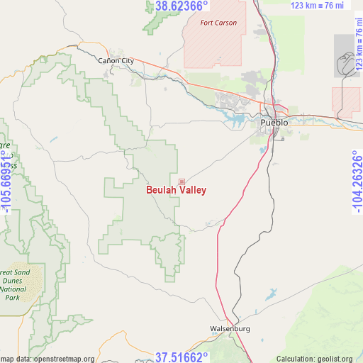
Beulah Valley GPS coordinates[2]
38° 4' 20.028" North, 104° 57' 58.968" West
| Map corner | latitude | longitude |
|---|---|---|
| Upper-left | 38.62366°, | -105.66951° |
| Center: | 38.07223°, | -104.96638° |
| Lower-right: | 37.51662°, | -104.26326° |
| Map W x H: | 123.1×123.1 km | = 76.5×76.5mi |
| max Lat: | 71.29058° ⇑61.2% North |
| Beulah Valley: | 38.07223° |
| min Lat: | ⇓38.8% South 19.06759° |
| min Long | Beulah Valley | max Long |
| -171.73463° | -104.96638° | -66.98998° |
| W 16.8%⇐ | ⇒83.2% E |
Elevation
Elevation of Beulah Valley is 1890 m = 6201 ft, and this is 1595.2 m = 5234 ft above average elevation for this country.
| Max E: |
3189 m = 10463 ft | 1.3% |
| Beulah Valley | 1890 m 6201 ft | |
| Avg. | 294.8 m = 967 ft | |
Min E: |
-60 m = -197 ft | 98.7% |
See also: United States elevation on elevation.city.
Geographical zone
Beulah Valley is located in North temperate zone (between Tropic of Cancer and the Arctic Circle). Distance of this Northern Tropic circle is 1627.3 km =1011.2 mi to South.| Distance of | km | miles | from Beulah Valley |
|---|---|---|---|
| North Pole | 5773.8 | 3587.7 | to North |
| Arctic Circle | 3167.9 | 1968.4 | to North |
| Tropic Cancer | 1627.3 | 1011.2 | to South |
| Equator | 4233.2 | 2630.4 | to South |


Nearby cities:
15 places around Beulah Valley: (largest is in red/bold)
• Avondale
56.8 km =35.3 mi,  71°
71°
• Blende
39.8 km =24.7 mi,  60°
60°
• Cañon City
47.6 km =29.6 mi,  329°
329°
• Colorado City
18.2 km =11.3 mi,  140°
140°
• Florence
37.8 km =23.5 mi,  339°
339°
• La Veta
63.2 km =39.3 mi,  183°
183°
• Lincoln Park
45.4 km =28.2 mi, 330°
• Penrose
39.5 km =24.5 mi,  352°
352°
• Pueblo
37.2 km =23.1 mi, 57°
• Pueblo West
37.5 km =23.3 mi,  34°
34°
• Salt Creek
38 km =23.6 mi, 60°
• Silver Cliff
42.6 km =26.5 mi,  279°
279°
• Walsenburg
52.4 km =32.6 mi,  161°
161°
• Westcliffe
44.2 km =27.5 mi, 279°
• Williamsburg
38.1 km =23.7 mi, 334°
Sources, notices
• [Note1] Compared only with cities in United States existing in our database
• [Src1] Map data: © OpenStreetMap contributors (CC-BY-SA)
• [Src2] Other city data from geonames.org with taken over terms of usage.
• [Src3] Geographical zone / Annual Mean Temperature by Robert A. Rohde @ Wikipedia
