Black Rock geodata
Black Rock (New Mexico) is a populated place; located in United States in America/Denver (GMT-6) time zone. With population of 1,323 people, there are 14471 cities with bigger population in this country. Compared to other cities in United States, 74.9% of cities are located further ↑North; 85.3% of cities are located further →East and 99% of cities have lower elevation than Black Rock. Note1


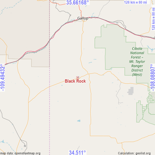
Black Rock GPS coordinates[2]
35° 5' 18.132" North, 108° 47' 28.284" West
| Map corner | latitude | longitude |
|---|---|---|
| Upper-left | 35.66168°, | -109.49432° |
| Center: | 35.08837°, | -108.79119° |
| Lower-right: | 34.511°, | -108.08807° |
| Map W x H: | 127.9×127.9 km | = 79.5×79.5mi |
| max Lat: | 71.29058° ⇑74.9% North |
| Black Rock: | 35.08837° |
| min Lat: | ⇓25.1% South 19.06759° |
| min Long | Black Rock | max Long |
| -171.73463° | -108.79119° | -66.98998° |
| W 14.7%⇐ | ⇒85.3% E |
Elevation
Elevation of Black Rock is 1972 m = 6470 ft, and this is 1677.2 m = 5503 ft above average elevation for this country.
| Max E: |
3189 m = 10463 ft | 1% |
| Black Rock | 1972 m 6470 ft | |
| Avg. | 294.8 m = 967 ft | |
Min E: |
-60 m = -197 ft | 99% |
See also: United States elevation on elevation.city.
Geographical zone
Black Rock is located in North temperate zone (between Tropic of Cancer and the Arctic Circle). Distance of this Northern Tropic circle is 1295.5 km =805 mi to South.| Distance of | km | miles | from Black Rock |
|---|---|---|---|
| North Pole | 6105.6 | 3793.8 | to North |
| Arctic Circle | 3499.7 | 2174.6 | to North |
| Tropic Cancer | 1295.5 | 805 | to South |
| Equator | 3901.5 | 2424.3 | to South |


Nearby cities:
15 places around Black Rock: (largest is in red/bold)
• Bluewater Village
75.1 km =46.7 mi,  78°
78°
• Church Rock
52.5 km =32.6 mi,  19°
19°
• Fort Defiance
77.4 km =48.1 mi,  340°
340°
• Gallup
49.1 km =30.5 mi,  5°
5°
• Houck
43.6 km =27.1 mi,  299°
299°
• Milan
82.4 km =51.2 mi, 83°
• Rock Springs
58 km =36 mi,  356°
356°
• Saint Michaels
67.7 km =42.1 mi, 335°
• San Rafael
82.7 km =51.4 mi,  88°
88°
• Sanders
51.3 km =31.9 mi,  286°
286°
• Thoreau
62.3 km =38.7 mi,  55°
55°
• Twin Lakes
69 km =42.9 mi,  1°
1°
• Window Rock
70 km =43.5 mi, 340°
• Yah-ta-hey
60 km =37.3 mi, 0°
• Zuni Pueblo
5.7 km =3.5 mi,  251°
251°
Sources, notices
• [Note1] Compared only with cities in United States existing in our database
• [Src1] Map data: © OpenStreetMap contributors (CC-BY-SA)
• [Src2] Other city data from geonames.org with taken over terms of usage.
• [Src3] Geographical zone / Annual Mean Temperature by Robert A. Rohde @ Wikipedia
