LaVerkin geodata
LaVerkin (Utah) is a populated place; located in United States in America/Denver (GMT-6) time zone. With population of 4,060 people, there are 8150 cities with bigger population in this country. Compared to other cities in United States, 65.3% of cities are located further ↑North; 88.3% of cities are located further →East and 93.3% of cities have lower elevation than LaVerkin. Note1


LaVerkin GPS coordinates[2]
37° 12' 3.924" North, 113° 16' 10.812" West
| Map corner | latitude | longitude |
|---|---|---|
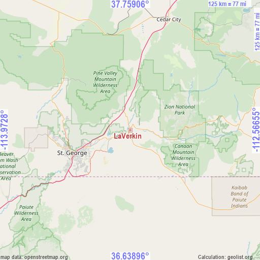
| Upper-left | 37.75906°, | -113.9728° |
| Center: | 37.20109°, | -113.26967° |
| Lower-right: | 36.63896°, | -112.56655° |
| Map W x H: | 124.5×124.5 km | = 77.4×77.4mi |
| max Lat: | 71.29058° ⇑65.3% North |
| LaVerkin: | 37.20109° |
| min Lat: | ⇓34.7% South 19.06759° |
| min Long | LaVerkin | max Long |
| -171.73463° | -113.26967° | -66.98998° |
| W 11.7%⇐ | ⇒88.3% E |
Elevation
Elevation of LaVerkin is 978 m = 3209 ft, and this is 683.2 m = 2241 ft above average elevation for this country.
| Max E: |
3189 m = 10463 ft | 6.7% |
| LaVerkin | 978 m 3209 ft | |
| Avg. | 294.8 m = 967 ft | |
Min E: |
-60 m = -197 ft | 93.3% |
See also: United States elevation on elevation.city.
Geographical zone
LaVerkin is located in North temperate zone (between Tropic of Cancer and the Arctic Circle). Distance of this Northern Tropic circle is 1530.5 km =951 mi to South.| Distance of | km | miles | from LaVerkin |
|---|---|---|---|
| North Pole | 5870.7 | 3647.9 | to North |
| Arctic Circle | 3264.8 | 2028.7 | to North |
| Tropic Cancer | 1530.5 | 951 | to South |
| Equator | 4136.4 | 2570.2 | to South |


Nearby cities:
15 places around LaVerkin: (largest is in red/bold)
• Apple Valley
17.9 km =11.1 mi,  133°
133°
• Centennial Park
37.6 km =23.4 mi,  137°
137°
• Central
39.5 km =24.5 mi,  307°
307°
• Colorado City
35.1 km =21.8 mi, 131°
• Dammeron Valley
37.3 km =23.2 mi,  288°
288°
• Hildale
34.7 km =21.6 mi, 129°
• Hurricane
3.4 km =2.1 mi,  212°
212°
• Ivins
36.5 km =22.7 mi,  264°
264°
• Leeds
9 km =5.6 mi,  297°
297°
• Saint George
29.9 km =18.6 mi,  248°
248°
• Santa Clara
34.9 km =21.7 mi, 257°
• Springdale
24.1 km =15 mi,  93°
93°
• Toquerville
6 km =3.7 mi,  347°
347°
• Virgin
7.3 km =4.5 mi,  83°
83°
• Washington
22.6 km =14 mi, 249°
Sources, notices
• [Note1] Compared only with cities in United States existing in our database
• [Src1] Map data: © OpenStreetMap contributors (CC-BY-SA)
• [Src2] Other city data from geonames.org with taken over terms of usage.
• [Src3] Geographical zone / Annual Mean Temperature by Robert A. Rohde @ Wikipedia
