Granby geodata
Granby (Colorado) is a populated place; located in United States in America/Denver (GMT-6) time zone. With population of 1,877 people, there are 12285 cities with bigger population in this country. Compared to other cities in United States, 54.4% of cities are located further ↓South; 83.8% of cities are located further →East and 99.8% of cities have lower elevation than Granby. Note1


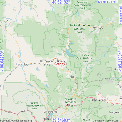
Granby GPS coordinates[2]
40° 5' 9.96" North, 105° 56' 22.056" West
| Map corner | latitude | longitude |
|---|---|---|
| Upper-left | 40.62192°, | -106.64259° |
| Center: | 40.0861°, | -105.93946° |
| Lower-right: | 39.54603°, | -105.23634° |
| Map W x H: | 119.6×119.6 km | = 74.3×74.3mi |
| max Lat: | 71.29058° ⇑45.6% North |
| Granby: | 40.0861° |
| min Lat: | ⇓54.4% South 19.06759° |
| min Long | Granby | max Long |
| -171.73463° | -105.93946° | -66.98998° |
| W 16.2%⇐ | ⇒83.8% E |
Elevation
Elevation of Granby is 2434 m = 7986 ft, and this is 2139.2 m = 7018 ft above average elevation for this country.
| Max E: |
3189 m = 10463 ft | 0.2% |
| Granby | 2434 m 7986 ft | |
| Avg. | 294.8 m = 967 ft | |
Min E: |
-60 m = -197 ft | 99.8% |
See also: United States elevation on elevation.city.
Geographical zone
Granby is located in North temperate zone (between Tropic of Cancer and the Arctic Circle). Distance of this Northern Tropic circle is 1851.2 km =1150.3 mi to South.| Distance of | km | miles | from Granby |
|---|---|---|---|
| North Pole | 5549.9 | 3448.5 | to North |
| Arctic Circle | 2944 | 1829.3 | to North |
| Tropic Cancer | 1851.2 | 1150.3 | to South |
| Equator | 4457.2 | 2769.6 | to South |


Nearby cities:
15 places around Granby: (largest is in red/bold)
• Allenspark
37.2 km =23.1 mi,  71°
71°
• Central City
48.1 km =29.9 mi,  131°
131°
• Coal Creek
51.9 km =32.2 mi,  112°
112°
• Dillon
51.5 km =32 mi,  189°
189°
• Downieville-Lawson-Dumont
45.1 km =28 mi,  142°
142°
• Estes Park
48 km =29.8 mi,  47°
47°
• Fraser
18.8 km =11.7 mi,  146°
146°
• Georgetown
47 km =29.2 mi, 153°
• Hot Sulphur Springs
14 km =8.7 mi,  264°
264°
• Idaho Springs
52.7 km =32.7 mi, 136°
• Kremmling
38.4 km =23.9 mi,  265°
265°
• Lazy Acres
51.6 km =32.1 mi,  89°
89°
• Nederland
39 km =24.2 mi, 110°
• Silverthorne
51.8 km =32.2 mi, 192°
• Winter Park
26.3 km =16.3 mi, 145°
Sources, notices
• [Note1] Compared only with cities in United States existing in our database
• [Src1] Map data: © OpenStreetMap contributors (CC-BY-SA)
• [Src2] Other city data from geonames.org with taken over terms of usage.
• [Src3] Geographical zone / Annual Mean Temperature by Robert A. Rohde @ Wikipedia
