Coal Creek geodata
Coal Creek (Colorado) is a populated place; located in United States in America/Denver (GMT-6) time zone. With population of 2,400 people, there are 10850 cities with bigger population in this country. Compared to other cities in United States, 52.5% of cities are located further ↓South; 83.6% of cities are located further →East and 99.9% of cities have lower elevation than Coal Creek. Note1


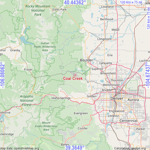
Coal Creek GPS coordinates[2]
39° 54' 22.968" North, 105° 22' 38.964" West
| Map corner | latitude | longitude |
|---|---|---|
| Upper-left | 40.44362°, | -106.08062° |
| Center: | 39.90638°, | -105.37749° |
| Lower-right: | 39.3649°, | -104.67437° |
| Map W x H: | 119.9×119.9 km | = 74.5×74.5mi |
| max Lat: | 71.29058° ⇑47.5% North |
| Coal Creek: | 39.90638° |
| min Lat: | ⇓52.5% South 19.06759° |
| min Long | Coal Creek | max Long |
| -171.73463° | -105.37749° | -66.98998° |
| W 16.4%⇐ | ⇒83.6% E |
Elevation
Elevation of Coal Creek is 2631 m = 8632 ft, and this is 2336.2 m = 7665 ft above average elevation for this country.
| Max E: |
3189 m = 10463 ft | 0.099999999999994% |
| Coal Creek | 2631 m 8632 ft | |
| Avg. | 294.8 m = 967 ft | |
Min E: |
-60 m = -197 ft | 99.9% |
See also: United States elevation on elevation.city.
Geographical zone
Coal Creek is located in North temperate zone (between Tropic of Cancer and the Arctic Circle). Distance of this Northern Tropic circle is 1831.3 km =1137.9 mi to South.| Distance of | km | miles | from Coal Creek |
|---|---|---|---|
| North Pole | 5569.9 | 3461 | to North |
| Arctic Circle | 2964 | 1841.7 | to North |
| Tropic Cancer | 1831.3 | 1137.9 | to South |
| Equator | 4437.2 | 2757.1 | to South |


Nearby cities:
15 places around Coal Creek: (largest is in red/bold)
• Applewood
24.7 km =15.3 mi,  131°
131°
• Boulder
15.1 km =9.4 mi,  37°
37°
• Broomfield
24.9 km =15.5 mi,  86°
86°
• Central City
16.5 km =10.3 mi,  225°
225°
• Eldorado Springs
9.1 km =5.7 mi,  71°
71°
• Golden
21.4 km =13.3 mi,  141°
141°
• Gunbarrel
24.8 km =15.4 mi,  45°
45°
• Idaho Springs
21.6 km =13.4 mi,  212°
212°
• Lazy Acres
21.1 km =13.1 mi,  10°
10°
• Louisville
22.4 km =13.9 mi, 69°
• Nederland
12.9 km =8 mi,  298°
298°
• Paragon Estates
19.2 km =11.9 mi,  64°
64°
• Pine Brook Hill
16.8 km =10.4 mi,  18°
18°
• Superior
18.5 km =11.5 mi, 73°
• West Pleasant View
25.7 km =16 mi, 138°
Sources, notices
• [Note1] Compared only with cities in United States existing in our database
• [Src1] Map data: © OpenStreetMap contributors (CC-BY-SA)
• [Src2] Other city data from geonames.org with taken over terms of usage.
• [Src3] Geographical zone / Annual Mean Temperature by Robert A. Rohde @ Wikipedia
