Dalton Gardens geodata
Dalton Gardens (Idaho) is a populated place; located in United States in America/Los_Angeles (GMT-7) time zone. With population of 2,386 people, there are 10887 cities with bigger population in this country. Compared to other cities in United States, 98.1% of cities are located further ↓South; 89.5% of cities are located further →East and 90.8% of cities have lower elevation than Dalton Gardens. Note1


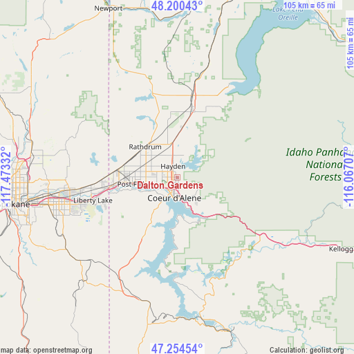
Dalton Gardens GPS coordinates[2]
47° 43' 46.668" North, 116° 46' 12.684" West
| Map corner | latitude | longitude |
|---|---|---|
| Upper-left | 48.20043°, | -117.47332° |
| Center: | 47.72963°, | -116.77019° |
| Lower-right: | 47.25454°, | -116.06707° |
| Map W x H: | 105.2×105.2 km | = 65.4×65.4mi |
| max Lat: | 71.29058° ⇑1.9% North |
| Dalton Gardens: | 47.72963° |
| min Lat: | ⇓98.1% South 19.06759° |
| min Long | Dalton Gardens | max Long |
| -171.73463° | -116.77019° | -66.98998° |
| W 10.5%⇐ | ⇒89.5% E |
Elevation
Elevation of Dalton Gardens is 690 m = 2264 ft, and this is 395.2 m = 1297 ft above average elevation for this country.
| Max E: |
3189 m = 10463 ft | 9.2% |
| Dalton Gardens | 690 m 2264 ft | |
| Avg. | 294.8 m = 967 ft | |
Min E: |
-60 m = -197 ft | 90.8% |
See also: United States elevation on elevation.city.
Geographical zone
Dalton Gardens is located in North temperate zone (between Tropic of Cancer and the Arctic Circle). Distance of this North polar circle is 2094.1 km =1301.2 mi to North.| Distance of | km | miles | from Dalton Gardens |
|---|---|---|---|
| North Pole | 4700 | 2920.4 | to North |
| Arctic Circle | 2094.1 | 1301.2 | to North |
| Tropic Cancer | 2701.1 | 1678.4 | to South |
| Equator | 5307 | 3297.6 | to South |


Nearby cities:
15 places around Dalton Gardens: (largest is in red/bold)
• Athol
24.7 km =15.3 mi,  10°
10°
• Coeur d'Alene
5.8 km =3.6 mi,  187°
187°
• Dishman
38.6 km =24 mi,  258°
258°
• Hauser
19.9 km =12.4 mi,  284°
284°
• Hayden
4.2 km =2.6 mi,  343°
343°
• Hayden Lake
3.4 km =2.1 mi,  17°
17°
• Liberty Lake
26.7 km =16.6 mi, 257°
• Opportunity
36.3 km =22.6 mi, 255°
• Otis Orchards-East Farms
23.3 km =14.5 mi, 264°
• Post Falls
13.6 km =8.5 mi, 264°
• Rathdrum
13.2 km =8.2 mi,  314°
314°
• Spirit Lake
27.3 km =17 mi, 344°
• Spokane Valley
35.7 km =22.2 mi, 259°
• Trentwood
33.2 km =20.6 mi, 263°
• Veradale
33.9 km =21.1 mi,  254°
254°
Sources, notices
• [Note1] Compared only with cities in United States existing in our database
• [Src1] Map data: © OpenStreetMap contributors (CC-BY-SA)
• [Src2] Other city data from geonames.org with taken over terms of usage.
• [Src3] Geographical zone / Annual Mean Temperature by Robert A. Rohde @ Wikipedia
