Ennis geodata
Ennis (Montana) is a populated place; located in United States in America/Denver (GMT-6) time zone. With population of 884 people, there are 17080 cities with bigger population in this country. Compared to other cities in United States, 93.6% of cities are located further ↓South; 86.8% of cities are located further →East and 96.7% of cities have lower elevation than Ennis. Note1


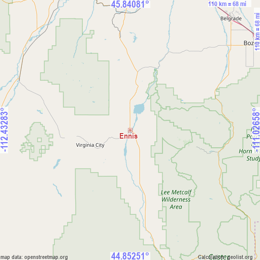
Ennis GPS coordinates[2]
45° 20' 55.752" North, 111° 43' 46.92" West
| Map corner | latitude | longitude |
|---|---|---|
| Upper-left | 45.84081°, | -112.43283° |
| Center: | 45.34882°, | -111.7297° |
| Lower-right: | 44.85251°, | -111.02658° |
| Map W x H: | 109.9×109.9 km | = 68.3×68.3mi |
| max Lat: | 71.29058° ⇑6.4% North |
| Ennis: | 45.34882° |
| min Lat: | ⇓93.6% South 19.06759° |
| min Long | Ennis | max Long |
| -171.73463° | -111.7297° | -66.98998° |
| W 13.2%⇐ | ⇒86.8% E |
Elevation
Elevation of Ennis is 1509 m = 4951 ft, and this is 1214.2 m = 3984 ft above average elevation for this country.
| Max E: |
3189 m = 10463 ft | 3.3% |
| Ennis | 1509 m 4951 ft | |
| Avg. | 294.8 m = 967 ft | |
Min E: |
-60 m = -197 ft | 96.7% |
See also: United States elevation on elevation.city.
Geographical zone
Ennis is located in North temperate zone (between Tropic of Cancer and the Arctic Circle). Distance of this North polar circle is 2358.9 km =1465.8 mi to North.| Distance of | km | miles | from Ennis |
|---|---|---|---|
| North Pole | 4964.7 | 3084.9 | to North |
| Arctic Circle | 2358.9 | 1465.8 | to North |
| Tropic Cancer | 2436.4 | 1513.9 | to South |
| Equator | 5042.3 | 3133.1 | to South |


Nearby cities:
15 places around Ennis: (largest is in red/bold)
• Belgrade
64.1 km =39.8 mi,  42°
42°
• Big Sky
29.1 km =18.1 mi,  104°
104°
• Bozeman
65.2 km =40.5 mi,  55°
55°
• Churchill
55.6 km =34.5 mi, 36°
• Dillon
72.5 km =45 mi,  258°
258°
• Four Corners
52.6 km =32.7 mi,  53°
53°
• Gallatin Gateway
49.5 km =30.8 mi, 56°
• Gardiner
87.6 km =54.4 mi,  113°
113°
• King Arthur Park
59 km =36.7 mi, 53°
• Manhattan
64.4 km =40 mi,  28°
28°
• Pray
82 km =51 mi,  87°
87°
• Sheridan
38.4 km =23.9 mi,  288°
288°
• Three Forks
62 km =38.5 mi,  12°
12°
• Virginia City
18 km =11.2 mi,  250°
250°
• Whitehall
64.7 km =40.2 mi,  333°
333°
Sources, notices
• [Note1] Compared only with cities in United States existing in our database
• [Src1] Map data: © OpenStreetMap contributors (CC-BY-SA)
• [Src2] Other city data from geonames.org with taken over terms of usage.
• [Src3] Geographical zone / Annual Mean Temperature by Robert A. Rohde @ Wikipedia
