Livingston geodata
Livingston (Montana) is a seat of a second-order administrative division; located in United States in America/Denver (GMT-6) time zone. With population of 7,302 people, there are 5649 cities with bigger population in this country. Compared to other cities in United States, 94.4% of cities are located further ↓South; 86% of cities are located further →East and 95.7% of cities have lower elevation than Livingston. Note1


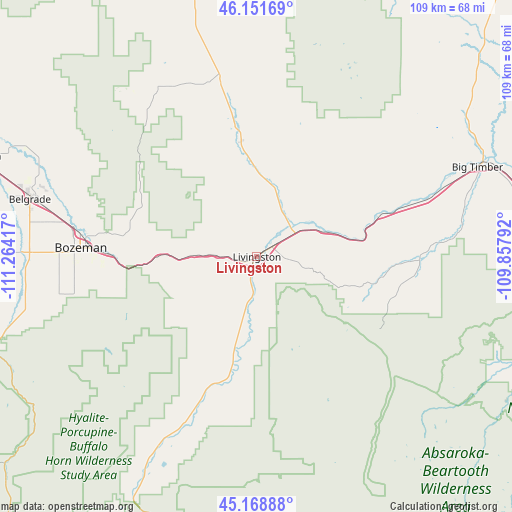
Livingston GPS coordinates[2]
45° 39' 44.784" North, 110° 33' 39.744" West
| Map corner | latitude | longitude |
|---|---|---|
| Upper-left | 46.15169°, | -111.26417° |
| Center: | 45.66244°, | -110.56104° |
| Lower-right: | 45.16888°, | -109.85792° |
| Map W x H: | 109.3×109.3 km | = 67.9×67.9mi |
| max Lat: | 71.29058° ⇑5.6% North |
| Livingston: | 45.66244° |
| min Lat: | ⇓94.4% South 19.06759° |
| min Long | Livingston | max Long |
| -171.73463° | -110.56104° | -66.98998° |
| W 14%⇐ | ⇒86% E |
Elevation
Elevation of Livingston is 1374 m = 4508 ft, and this is 1079.2 m = 3541 ft above average elevation for this country.
| Max E: |
3189 m = 10463 ft | 4.3% |
| Livingston | 1374 m 4508 ft | |
| Avg. | 294.8 m = 967 ft | |
Min E: |
-60 m = -197 ft | 95.7% |
See also: United States elevation on elevation.city.
Geographical zone
Livingston is located in North temperate zone (between Tropic of Cancer and the Arctic Circle). Distance of this North polar circle is 2324 km =1444.1 mi to North.| Distance of | km | miles | from Livingston |
|---|---|---|---|
| North Pole | 4929.9 | 3063.3 | to North |
| Arctic Circle | 2324 | 1444.1 | to North |
| Tropic Cancer | 2471.3 | 1535.6 | to South |
| Equator | 5077.2 | 3154.8 | to South |


Nearby cities:
15 places around Livingston: (largest is in red/bold)
• Absarokee
88.4 km =54.9 mi,  100°
100°
• Belgrade
49.4 km =30.7 mi,  284°
284°
• Big Sky
75.7 km =47 mi,  236°
236°
• Big Timber
50.8 km =31.6 mi,  67°
67°
• Bozeman
37.2 km =23.1 mi,  272°
272°
• Churchill
58.5 km =36.4 mi, 279°
• Columbus
101.8 km =63.3 mi,  91°
91°
• Ennis
97.5 km =60.6 mi,  249°
249°
• Four Corners
48.7 km =30.3 mi, 265°
• Gallatin Gateway
50.1 km =31.1 mi,  260°
260°
• Gardiner
71 km =44.1 mi,  189°
189°
• King Arthur Park
43.7 km =27.2 mi, 270°
• Manhattan
63.6 km =39.5 mi,  289°
289°
• Pray
32.8 km =20.4 mi,  196°
196°
• Three Forks
81 km =50.3 mi, 288°
Sources, notices
• [Note1] Compared only with cities in United States existing in our database
• [Src1] Map data: © OpenStreetMap contributors (CC-BY-SA)
• [Src2] Other city data from geonames.org with taken over terms of usage.
• [Src3] Geographical zone / Annual Mean Temperature by Robert A. Rohde @ Wikipedia
