Montana City geodata
Montana City (Montana) is a populated place; located in United States in America/Denver (GMT-6) time zone. With population of 2,715 people, there are 10145 cities with bigger population in this country. Compared to other cities in United States, 95.9% of cities are located further ↓South; 87.3% of cities are located further →East and 94.8% of cities have lower elevation than Montana City. Note1


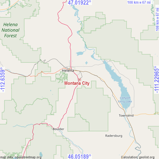
Montana City GPS coordinates[2]
46° 32' 15.756" North, 111° 55' 57.972" West
| Map corner | latitude | longitude |
|---|---|---|
| Upper-left | 47.01922°, | -112.6359° |
| Center: | 46.53771°, | -111.93277° |
| Lower-right: | 46.05189°, | -111.22965° |
| Map W x H: | 107.6×107.6 km | = 66.9×66.9mi |
| max Lat: | 71.29058° ⇑4.1% North |
| Montana City: | 46.53771° |
| min Lat: | ⇓95.9% South 19.06759° |
| min Long | Montana City | max Long |
| -171.73463° | -111.93277° | -66.98998° |
| W 12.7%⇐ | ⇒87.3% E |
Elevation
Elevation of Montana City is 1234 m = 4049 ft, and this is 939.2 m = 3081 ft above average elevation for this country.
| Max E: |
3189 m = 10463 ft | 5.2% |
| Montana City | 1234 m 4049 ft | |
| Avg. | 294.8 m = 967 ft | |
Min E: |
-60 m = -197 ft | 94.8% |
See also: United States elevation on elevation.city.
Geographical zone
Montana City is located in North temperate zone (between Tropic of Cancer and the Arctic Circle). Distance of this North polar circle is 2226.7 km =1383.6 mi to North.| Distance of | km | miles | from Montana City |
|---|---|---|---|
| North Pole | 4832.6 | 3002.8 | to North |
| Arctic Circle | 2226.7 | 1383.6 | to North |
| Tropic Cancer | 2568.6 | 1596.1 | to South |
| Equator | 5174.5 | 3215.3 | to South |


Nearby cities:
15 places around Montana City: (largest is in red/bold)
• Boulder
36.5 km =22.7 mi,  203°
203°
• Clancy
9 km =5.6 mi,  206°
206°
• Deer Lodge
63.1 km =39.2 mi,  255°
255°
• East Helena
5.9 km =3.7 mi,  12°
12°
• Helena
10 km =6.2 mi,  307°
307°
• Helena Valley Northeast
18 km =11.2 mi,  355°
355°
• Helena Valley Northwest
23.5 km =14.6 mi,  334°
334°
• Helena Valley Southeast
8.7 km =5.4 mi, 5°
• Helena Valley West Central
17 km =10.6 mi,  324°
324°
• Helena West Side
15.3 km =9.5 mi,  295°
295°
• Lincoln
73.5 km =45.7 mi, 309°
• South Hills
5.4 km =3.4 mi,  293°
293°
• The Silos
31.3 km =19.4 mi,  121°
121°
• Townsend
39.8 km =24.7 mi,  127°
127°
• Walkerville
72.7 km =45.2 mi,  219°
219°
Sources, notices
• [Note1] Compared only with cities in United States existing in our database
• [Src1] Map data: © OpenStreetMap contributors (CC-BY-SA)
• [Src2] Other city data from geonames.org with taken over terms of usage.
• [Src3] Geographical zone / Annual Mean Temperature by Robert A. Rohde @ Wikipedia
