Helena Valley Southeast geodata
Helena Valley Southeast (Montana) is a populated place; located in United States in America/Denver (GMT-6) time zone. With population of 8,227 people, there are 5176 cities with bigger population in this country. Compared to other cities in United States, 96% of cities are located further ↓South; 87.3% of cities are located further →East and 94.3% of cities have lower elevation than Helena Valley Southeast. Note1
Current local time in Helena Valley Southeast:
09:09 PM, SundayDifference from your time zone: hours


Helena Valley Southeast GPS coordinates[2]
46° 36' 54.972" North, 111° 55' 17.616" West
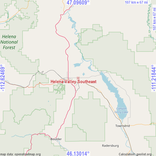
| Map corner | latitude | longitude |
|---|---|---|
| Upper-left | 47.09609°, | -112.62469° |
| Center: | 46.61527°, | -111.92156° |
| Lower-right: | 46.13014°, | -111.21844° |
| Map W x H: | 107.4×107.4 km | = 66.7×66.7mi |
| max Lat: | 71.29058° ⇑4% North |
| Helena Valley Southeast: | 46.61527° |
| min Lat: | ⇓96% South 19.06759° |
| min Long | Helena Valley S | max Long |
| -171.73463° | -111.92156° | -66.98998° |
| W 12.7%⇐ | ⇒87.3% E |
Elevation
Elevation of Helena Valley Southeast is 1156 m = 3793 ft, and this is 861.2 m = 2825 ft above average elevation for this country.
| Max E: |
3189 m = 10463 ft | 5.7% |
| Helena Valley Southeast | 1156 m 3793 ft | |
| Avg. | 294.8 m = 967 ft | |
Min E: |
-60 m = -197 ft | 94.3% |
See also: United States elevation on elevation.city.
Geographical zone
Helena Valley Southeast is located in North temperate zone (between Tropic of Cancer and the Arctic Circle). Distance of this North polar circle is 2218 km =1378.2 mi to North.| Distance of | km | miles | from Helena Valley Southeast |
|---|---|---|---|
| North Pole | 4823.9 | 2997.4 | to North |
| Arctic Circle | 2218 | 1378.2 | to North |
| Tropic Cancer | 2577.2 | 1601.4 | to South |
| Equator | 5183.1 | 3220.6 | to South |


Nearby cities:
15 places around Helena Valley Southeast: (largest is in red/bold)
• Boulder
44.8 km =27.8 mi,  199°
199°
• Cascade
74.8 km =46.5 mi,  12°
12°
• Clancy
17.4 km =10.8 mi, 196°
• Deer Lodge
66.5 km =41.3 mi,  248°
248°
• East Helena
2.9 km =1.8 mi,  170°
170°
• Helena
9.1 km =5.7 mi, 254°
• Helena Valley Northeast
9.6 km =6 mi,  345°
345°
• Helena Valley Northwest
16.6 km =10.3 mi,  319°
319°
• Helena Valley West Central
11.9 km =7.4 mi,  296°
296°
• Helena West Side
14.8 km =9.2 mi,  261°
261°
• Lincoln
69.1 km =42.9 mi, 303°
• Montana City
8.7 km =5.4 mi,  185°
185°
• South Hills
8.7 km =5.4 mi,  221°
221°
• The Silos
36 km =22.4 mi,  134°
134°
• Townsend
45 km =28 mi,  137°
137°
Sources, notices
• [Note1] Compared only with cities in United States existing in our database
• [Src1] Map data: © OpenStreetMap contributors (CC-BY-SA)
• [Src2] Other city data from geonames.org with taken over terms of usage.
• [Src3] Geographical zone / Annual Mean Temperature by Robert A. Rohde @ Wikipedia
