Glen Ullin geodata
Glen Ullin (North Dakota) is a populated place; located in United States in America/North_Dakota/New_Salem (GMT-5) time zone. With population of 743 people, there are 18279 cities with bigger population in this country. Compared to other cities in United States, 96.3% of cities are located further ↓South; 81.8% of cities are located further →East and 90.2% of cities have lower elevation than Glen Ullin. Note1
Administrative division(s):
- Level 1: North Dakota
- Level 2: Morton County
- Level 3: City of Glen Ullin


Glen Ullin GPS coordinates[2]
46° 48' 54.036" North, 101° 49' 47.568" West
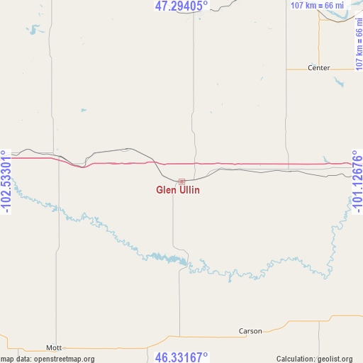
| Map corner | latitude | longitude |
|---|---|---|
| Upper-left | 47.29405°, | -102.53301° |
| Center: | 46.81501°, | -101.82988° |
| Lower-right: | 46.33167°, | -101.12676° |
| Map W x H: | 107×107 km | = 66.5×66.5mi |
| max Lat: | 71.29058° ⇑3.7% North |
| Glen Ullin: | 46.81501° |
| min Lat: | ⇓96.3% South 19.06759° |
| min Long | Glen Ullin | max Long |
| -171.73463° | -101.82988° | -66.98998° |
| W 18.2%⇐ | ⇒81.8% E |
Elevation
Elevation of Glen Ullin is 635 m = 2083 ft, and this is 340.2 m = 1116 ft above average elevation for this country.
| Max E: |
3189 m = 10463 ft | 9.8% |
| Glen Ullin | 635 m 2083 ft | |
| Avg. | 294.8 m = 967 ft | |
Min E: |
-60 m = -197 ft | 90.2% |
See also: United States elevation on elevation.city.
Geographical zone
Glen Ullin is located in North temperate zone (between Tropic of Cancer and the Arctic Circle). Distance of this North polar circle is 2195.8 km =1364.4 mi to North.| Distance of | km | miles | from Glen Ullin |
|---|---|---|---|
| North Pole | 4801.7 | 2983.6 | to North |
| Arctic Circle | 2195.8 | 1364.4 | to North |
| Tropic Cancer | 2599.4 | 1615.2 | to South |
| Equator | 5205.3 | 3234.4 | to South |


Nearby cities:
15 places around Glen Ullin: (largest is in red/bold)
• Beulah
50 km =31.1 mi,  4°
4°
• Bismarck
79.6 km =49.5 mi,  90°
90°
• Carson
48.6 km =30.2 mi,  155°
155°
• Center
52.4 km =32.6 mi,  50°
50°
• Dickinson
73.3 km =45.5 mi,  275°
275°
• Elgin
45.7 km =28.4 mi,  181°
181°
• Hazen
55.6 km =34.5 mi,  16°
16°
• Hebron
18.9 km =11.7 mi,  300°
300°
• Mandan
71.6 km =44.5 mi, 88°
• Mott
62.2 km =38.6 mi,  217°
217°
• New England
84.9 km =52.8 mi,  248°
248°
• New Salem
32 km =19.9 mi,  84°
84°
• Richardton
37.7 km =23.4 mi, 281°
• Stanton
65.7 km =40.8 mi,  31°
31°
• Washburn
80.4 km =50 mi, 49°
Sources, notices
• [Note1] Compared only with cities in United States existing in our database
• [Src1] Map data: © OpenStreetMap contributors (CC-BY-SA)
• [Src2] Other city data from geonames.org with taken over terms of usage.
• [Src3] Geographical zone / Annual Mean Temperature by Robert A. Rohde @ Wikipedia
