Beulah geodata
Beulah (North Dakota) is a populated place; located in United States in America/North_Dakota/Beulah (GMT-5) time zone. With population of 3,393 people, there are 9004 cities with bigger population in this country. Compared to other cities in United States, 97.1% of cities are located further ↓South; 81.7% of cities are located further →East and 88.7% of cities have lower elevation than Beulah. Note1


Beulah GPS coordinates[2]
47° 15' 48.024" North, 101° 46' 40.62" West
| Map corner | latitude | longitude |
|---|---|---|
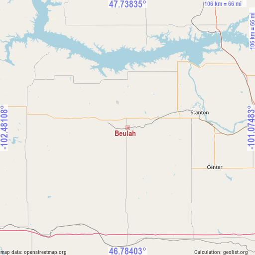
| Upper-left | 47.73835°, | -102.48108° |
| Center: | 47.26334°, | -101.77795° |
| Lower-right: | 46.78403°, | -101.07483° |
| Map W x H: | 106.1×106.1 km | = 65.9×65.9mi |
| max Lat: | 71.29058° ⇑2.9% North |
| Beulah: | 47.26334° |
| min Lat: | ⇓97.1% South 19.06759° |
| min Long | Beulah | max Long |
| -171.73463° | -101.77795° | -66.98998° |
| W 18.3%⇐ | ⇒81.7% E |
Elevation
Elevation of Beulah is 542 m = 1778 ft, and this is 247.2 m = 811 ft above average elevation for this country.
| Max E: |
3189 m = 10463 ft | 11.3% |
| Beulah | 542 m 1778 ft | |
| Avg. | 294.8 m = 967 ft | |
Min E: |
-60 m = -197 ft | 88.7% |
See also: United States elevation on elevation.city.
Geographical zone
Beulah is located in North temperate zone (between Tropic of Cancer and the Arctic Circle). Distance of this North polar circle is 2146 km =1333.5 mi to North.| Distance of | km | miles | from Beulah |
|---|---|---|---|
| North Pole | 4751.9 | 2952.7 | to North |
| Arctic Circle | 2146 | 1333.5 | to North |
| Tropic Cancer | 2649.3 | 1646.2 | to South |
| Equator | 5255.2 | 3265.4 | to South |


Nearby cities:
15 places around Beulah: (largest is in red/bold)
• Center
39.7 km =24.7 mi,  114°
114°
• Garrison
51.1 km =31.8 mi,  32°
32°
• Glen Ullin
50 km =31.1 mi,  184°
184°
• Hazen
12.2 km =7.6 mi,  73°
73°
• Hebron
45.1 km =28 mi,  206°
206°
• Killdeer
74.6 km =46.4 mi,  279°
279°
• Manning
75 km =46.6 mi,  267°
267°
• New Salem
54.2 km =33.7 mi,  149°
149°
• Parshall
81.3 km =50.5 mi,  340°
340°
• Richardton
58.6 km =36.4 mi,  223°
223°
• Stanton
30.6 km =19 mi,  77°
77°
• Turtle Lake
72.7 km =45.2 mi, 66°
• Underwood
52.8 km =32.8 mi, 66°
• Washburn
56.6 km =35.2 mi,  87°
87°
• Wilton
76 km =47.2 mi,  98°
98°
Sources, notices
• [Note1] Compared only with cities in United States existing in our database
• [Src1] Map data: © OpenStreetMap contributors (CC-BY-SA)
• [Src2] Other city data from geonames.org with taken over terms of usage.
• [Src3] Geographical zone / Annual Mean Temperature by Robert A. Rohde @ Wikipedia
