Scottsbluff geodata
Scottsbluff (Nebraska) is a populated place; located in United States in America/Denver (GMT-6) time zone. With population of 14,802 people, there are 3282 cities with bigger population in this country. Compared to other cities in United States, 74.5% of cities are located further ↓South; 82.5% of cities are located further →East and 94.5% of cities have lower elevation than Scottsbluff. Note1
Administrative division(s):
- Level 1: Nebraska
- Level 2: Scotts Bluff County
- Level 3: City of Scottsbluff


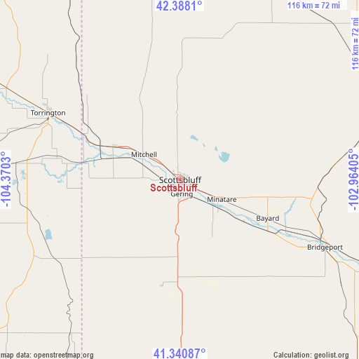
Scottsbluff GPS coordinates[2]
41° 51' 59.868" North, 103° 40' 1.812" West
| Map corner | latitude | longitude |
|---|---|---|
| Upper-left | 42.3881°, | -104.3703° |
| Center: | 41.86663°, | -103.66717° |
| Lower-right: | 41.34087°, | -102.96405° |
| Map W x H: | 116.4×116.4 km | = 72.3×72.3mi |
| max Lat: | 71.29058° ⇑25.5% North |
| Scottsbluff: | 41.86663° |
| min Lat: | ⇓74.5% South 19.06759° |
| min Long | Scottsbluff | max Long |
| -171.73463° | -103.66717° | -66.98998° |
| W 17.5%⇐ | ⇒82.5% E |
Elevation
Elevation of Scottsbluff is 1187 m = 3894 ft, and this is 892.2 m = 2927 ft above average elevation for this country.
| Max E: |
3189 m = 10463 ft | 5.5% |
| Scottsbluff | 1187 m 3894 ft | |
| Avg. | 294.8 m = 967 ft | |
Min E: |
-60 m = -197 ft | 94.5% |
See also: United States elevation on elevation.city.
Geographical zone
Scottsbluff is located in North temperate zone (between Tropic of Cancer and the Arctic Circle). Distance of this Northern Tropic circle is 2049.2 km =1273.3 mi to South.| Distance of | km | miles | from Scottsbluff |
|---|---|---|---|
| North Pole | 5351.9 | 3325.5 | to North |
| Arctic Circle | 2746 | 1706.3 | to North |
| Tropic Cancer | 2049.2 | 1273.3 | to South |
| Equator | 4655.1 | 2892.5 | to South |


Nearby cities:
15 places around Scottsbluff: (largest is in red/bold)
• Alliance
70.7 km =43.9 mi,  68°
68°
• Bayard
31 km =19.3 mi,  113°
113°
• Bridgeport
52.2 km =32.4 mi,  115°
115°
• Crawford
93.2 km =57.9 mi,  12°
12°
• Gering
4.6 km =2.9 mi,  173°
173°
• Harrisburg
35 km =21.7 mi,  189°
189°
• Harrison
92.9 km =57.7 mi,  349°
349°
• Hemingford
70.4 km =43.7 mi,  44°
44°
• Kimball
70.1 km =43.6 mi,  179°
179°
• Minatare
15 km =9.3 mi, 115°
• Mitchell
14.3 km =8.9 mi,  304°
304°
• Morrill
24 km =14.9 mi, 296°
• Pine Bluffs
83.2 km =51.7 mi,  203°
203°
• Terrytown
2.2 km =1.4 mi, 167°
• Torrington
48 km =29.8 mi, 296°
Sources, notices
• [Note1] Compared only with cities in United States existing in our database
• [Src1] Map data: © OpenStreetMap contributors (CC-BY-SA)
• [Src2] Other city data from geonames.org with taken over terms of usage.
• [Src3] Geographical zone / Annual Mean Temperature by Robert A. Rohde @ Wikipedia
