Culp Creek geodata
Culp Creek (Oregon) is a populated place; located in United States in America/Los_Angeles (GMT-7) time zone. With population of 2,000 people, there are 11941 cities with bigger population in this country. Compared to other cities in United States, 87.2% of cities are located further ↓South; 97.6% of cities are located further →East and 71.7% of cities have lower elevation than Culp Creek. Note1


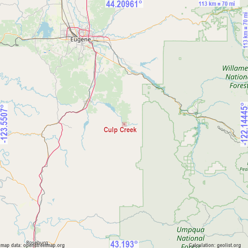
Culp Creek GPS coordinates[2]
43° 42' 12.456" North, 122° 50' 51.252" West
| Map corner | latitude | longitude |
|---|---|---|
| Upper-left | 44.20961°, | -123.5507° |
| Center: | 43.70346°, | -122.84757° |
| Lower-right: | 43.193°, | -122.14445° |
| Map W x H: | 113×113 km | = 70.2×70.2mi |
| max Lat: | 71.29058° ⇑12.8% North |
| Culp Creek: | 43.70346° |
| min Lat: | ⇓87.2% South 19.06759° |
| min Long | Culp Creek | max Long |
| -171.73463° | -122.84757° | -66.98998° |
| W 2.4%⇐ | ⇒97.6% E |
Elevation
Elevation of Culp Creek is 294 m = 965 ft, and this is 0.80000000000001 m = 3 ft below average elevation for this country.
| Max E: |
3189 m = 10463 ft | 28.3% |
| Avg. | 294.8 m = 967 ft | |
| Culp Creek | 294 m = 965 ft | |
Min E: |
-60 m = -197 ft | 71.7% |
See also: United States elevation on elevation.city.
Geographical zone
Culp Creek is located in North temperate zone (between Tropic of Cancer and the Arctic Circle). Distance of this Northern Tropic circle is 2253.5 km =1400.3 mi to South.| Distance of | km | miles | from Culp Creek |
|---|---|---|---|
| North Pole | 5147.7 | 3198.6 | to North |
| Arctic Circle | 2541.8 | 1579.4 | to North |
| Tropic Cancer | 2253.5 | 1400.3 | to South |
| Equator | 4859.4 | 3019.5 | to South |


Nearby cities:
15 places around Culp Creek: (largest is in red/bold)
• Coburg
51.3 km =31.9 mi,  340°
340°
• Cottage Grove
20 km =12.4 mi,  301°
301°
• Creswell
27.8 km =17.3 mi,  329°
329°
• Drain
38.2 km =23.7 mi,  262°
262°
• Eugene
43.2 km =26.8 mi, 333°
• Glide
49.2 km =30.6 mi,  204°
204°
• Junction City
64.1 km =39.8 mi, 333°
• Lowell
24.4 km =15.2 mi,  12°
12°
• Oakland
47.9 km =29.8 mi,  229°
229°
• Oakridge
31.4 km =19.5 mi,  81°
81°
• Roseburg North
61.1 km =38 mi,  216°
216°
• Springfield
40.6 km =25.2 mi, 339°
• Sutherlin
51.2 km =31.8 mi, 227°
• Veneta
55.7 km =34.6 mi,  313°
313°
• Yoncalla
37 km =23 mi,  251°
251°
Sources, notices
• [Note1] Compared only with cities in United States existing in our database
• [Src1] Map data: © OpenStreetMap contributors (CC-BY-SA)
• [Src2] Other city data from geonames.org with taken over terms of usage.
• [Src3] Geographical zone / Annual Mean Temperature by Robert A. Rohde @ Wikipedia
